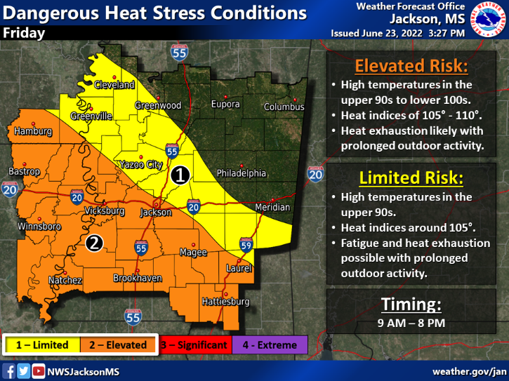
The thing about being stuck under a ridge of high pressure is that similar conditions seem to persist for a while. That is exactly what we are experiencing in southwest Mississippi. Thursday was very hot with high heat indices and isolated storms. Friday will be almost a carbon copy. Temperatures on Friday will reach the upper 90s in most counties with triple digits possible. Heat indices between 100F and 110F are possible in the area prompting a heat advisory from 9 AM CDT to 8 PM CDT.
As always, stay hydrated and limit time spent outdoors during the afternoon and early evening hours.
Rain chances become increased Friday and more so on Sunday before the start of next week. Typical of summertime near the Gulf Coast are those pop up showers and storms that take advantage of the daytime heating. Friday’s storms will be very isolated if that convection can get going. Model data seems to suggest just enough vertical forcing to help the atmosphere pop off a few storms. Areas that see this rainfall will get a decrease in temperature, albeit an increase in humidity as well.
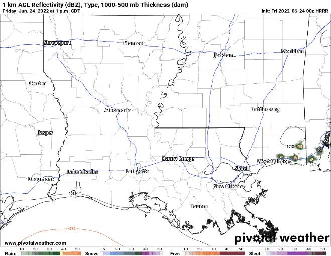
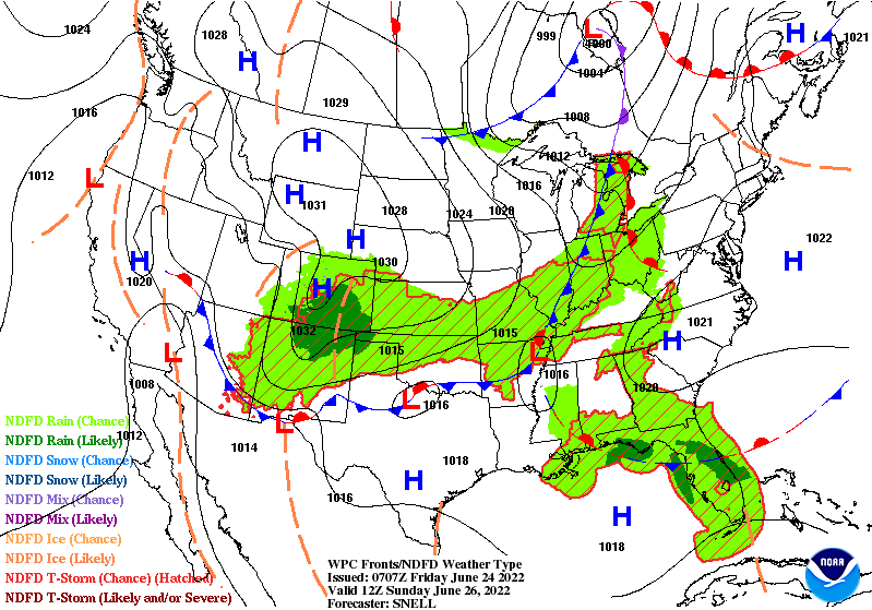
That circle of dark green above is the GFS model indicating a possible downburst from a storm with the winds diverging from the center associated with an increase in relative humidity at around 80-percent. The increase in moisture with precipitable water values north of 1.8″ in SW MS will help those storms produce locally heavy rainfall possibly. You can stay up to date with current radar with the interactive satellite and radar here..
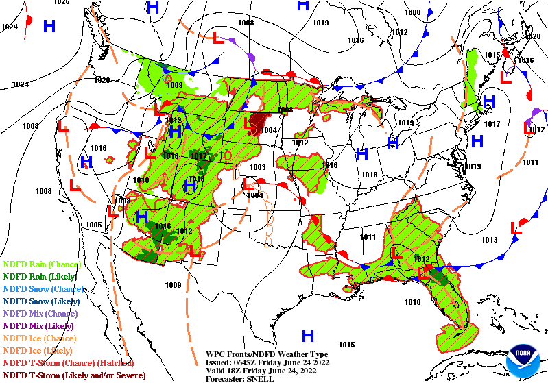
This increased rain chance is due to a surface front moving its way down south late Friday to early Saturday. Behind this front will be slightly drier conditions helping to dampen rain chances Saturday before more moisture is brought in from the Gulf to help showers and storms develop on Sunday.
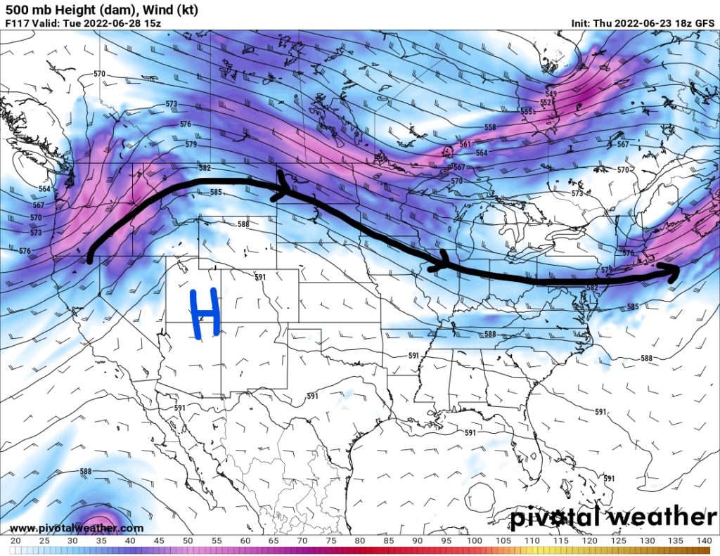
Looking ahead to next week, that dominating high pressure ridge in the upper-levels will back to the west. Temperatures will ease off to the upper 80s and lower 90s by mid-week, which is more typical for late June.
Day-to-Day Forecast
Friday
Mostly sunny with a 30-percent chance of isolated storms in the late afternoon. Highs in the upper 90s possibly hitting 100F or higher. Heat indices from 100F to 110F possible. Overnight lows in mid 70s.
Saturday
Sunny with late clouds and a 20-percent chance of rain. Highs in the upper 90s and low 100s. Heat indices between 100F and 105F. Overnight lows in the mid 70s.
Sunday
Mostly cloudy with a 30-percent chance of precipitation. Highs in the upper 90s with the heat index over 100F. Overnight lows in the mid 70s.
Monday
Mostly cloudy with a 50-percent chance of precipitation. Highs in the low-to-mid 90s and lows in the low 70s.
Tuesday
Mostly cloudy with a 30-percent chance of precipitation. Highs in the mid 90s and lows in the low 70s.
Wednesday
Partly cloudy with a 30-percent chance of precipitation. Highs in the low-to-mid 90s and lows in the low 70s.
Thursday
Partly cloudy with a 30-percent chance of precipitation. Highs in the mid-to-upper 90s and lows in the low 70s.


One thought on “Extreme Heat Alongside Elevated Rain Chances Heading into the Weekend: SW MS Weather Forecast – 6/24/22”
Comments are closed.