Good morning everyone and happy Friday! I hope these updates continue to provide slightly better news each time, as we are continuing to track a pattern change for more active weather and the chance for slightly cooler temperatures into the upcoming week.
However, before we get to the slightly cooler weather and more chances for rain, we do have a couple more days of hot weather to get through.

For the day today, the NWS has issued a Heat Advisory in the orange colors for areas where heat indexes could reach in the 100F-107F range. The Heat Advisory covers much of southeast Mississippi, western Mississippi and portions of southern Alabama. There is even an excessive heat warning for portions of the coast including coast Mississippi where the heat indexes will be the highest given the higher dew points making it “feel” hotter.
With dew points tomorrow expected to hover around the upper 60s to low 70s and high temperatures close to 100, it will be a hot one out there!

In terms of precipitation on Friday, there is potential for storms to develop tomorrow as a small disturbance tries to make its way across our area of the edge of the upper-level ridge that has been over our area for quite a while.

As this dry air pushes further towards the south and creates a moisture boundary with it, some of the convective models are suggesting the possibility for isolated pop-up thunderstorms and showers. However, many model soundings are showing little to no vertical velocity above the area of saturation, this means that despite the available moisture, storms are unlikely as there is not sufficient dynamics and instability to push parcels of air upwards and create showers and thunderstorms.
In addition, depending on how far south that drier boundary makes it, we could see the potential for some drier air to mix in allowing dew points at the surface to fall slightly from near 70 to the low to mid 60s, however the chances of this are greater in northern portions of Mississippi and Alabama.
Moving forward throughout the weekend and into early next week, a disturbance from the north wrapping around the upper-level ridge makes its way to the coast of the Mississippi and Alabama, bringing our highest chance for more widespread precipitation.

As the upper-level disturbance continues to wrap around the edge of the ridge, a weak surface low looks to form across Mississippi and Alabama, bringing better chances for widespread rain Sunday into Monday.
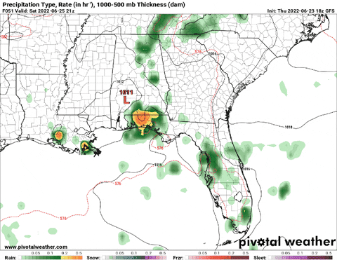
While the chance is still not perfect, a surface low formation will provide a better inflow of warm air advection off of the Gulf of Mexico and sufficient vorticity which both work to increase rising motion to help form clouds and rain that will fall back towards the surface.
Looking into the rest of the week, it looks like the dominating ridge will move further to the west of the CONUS. With the ridge not directly over our region, this will allow for temperatures to drop slightly back towards manageable levels (still hot but not as hot) into the low to mid 90s. This also will allow for less subsidence or downward motion to occur, which means that there will be greater chances for more routine showers and thunderstorms to potentially cool things off.

Day to Day Forecast
Today
30-percent chance of an isolated afternoon shower or thunderstorm. Mostly sunny and hot with high temperatures near 100. Heat index may reach 105. Wind northwest at 5 to 10mph.
Tonight
Mostly clear with lows in the mid 70s. Wind calm.
Saturday
Mostly sunny with a 30-percent chance of afternoon / evening showers and thunderstorms. Highs near 100 with a heat indexes reaching up to 105. Wind north to northeast at 5 to 10mph.
Saturday Night
Partly cloudy with lows in the mid 70s. Wind calm.
Sunday
60-percent chance of afternoon showers / thunderstorms. Mostly sunny with increasing clouds throughout the day. Highs in the upper 90s with a heat index near 104. Wind east at 5mph.
Sunday Night
20-percent chance of showers and thunderstorms. Partly cloudy with lows in the mid 70s. Wind calm.
Monday
Mix of sun and clouds with a 60-percent chance of afternoon showers and thunderstorms. Highs in the mid 90s with heat indexes near 101. Wind north 5 to 10mph.
Monday Night
20-percent chance of lingering showers and thunderstorms. Mostly cloudy with lows in the mid 70s. Wind calm.
Tuesday
40-percent chance of showers and thunderstorms. Mostly sunny with highs in the low to mid 90s. Heat index near 100. Wind northeast at 5mph.
Tuesday Night
Mostly cloudy with a 20-percent chance of showers. Lows in the low 70s. Wind calm.
Wednesday
Mix of sun and clouds with 30-percent chance of afternoon showers and thunderstorms. Highs in the low to mid 90s with a heat index near 100. Wind southeast 5mph.
Wednesday Night
Partly cloudy with a 20-percent chance of showers. Lows in the low 70s. Wind southeast 5mph.
Thursday
Mostly sunny with a 40-percent chance of afternoon showers and thunderstorms. Highs in the lower 90s. Heat index near 100. Wind south 5mph.
Thursday Night
20-percent chance of showers. Partly cloudy with lows in the mid 70s. Wind calm.


The animation gif is useless unless you can provide a way to pause and advance frame by frame so that you can keep up with the time things are happening.