It’s the stagnant days of summer. Large ridge, no shear, bigtime humidity. And now we’re about to get the hottest temperatures of the year.
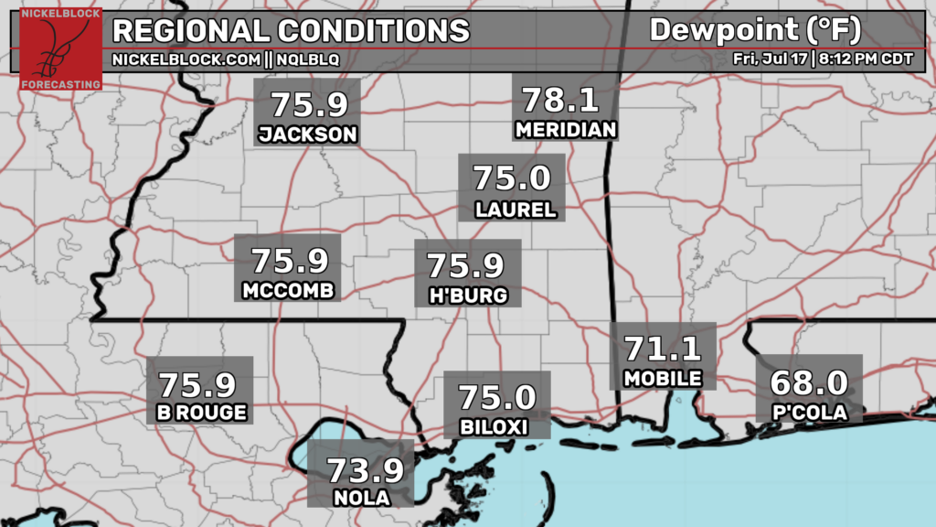
Those dew points aren’t uncommon for July but that doesn’t make them any more enjoyable. Given that temperatures may hit triple digits by next week it’s pretty easy to say that it’ll be extremely unpleasant outside.
Rain chances look pretty low for the next few days. As usual, they’ll probably be a few afternoon pulse storms during that time but at the moment it looks the problems will come from the clear sky and not the storm clouds.
Unfortunately it looks like the heat will stick around for a while so make sure your AC is in working order.

Tonight
The best way to describe it is “Steamy”. While it won’t rain it’ll be humid. Very humid.
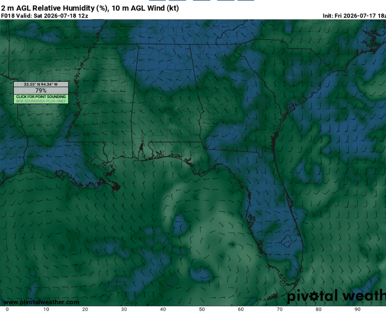
Given the clear skies, light winds, and position of the high, fog could definitely be in the cards. This will be most likely in river valleys and low lying areas. Make sure to be cautious and dry slow when encountering low visibility.
Lows will be in the mid 70s, allowing for little in the way of heat relief when factoring in the near saturation.
Tomorrow
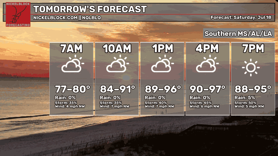
Just a warm up. Literally.
It’ll still be hot though. Highs are expected to be in the mid 90s with intense humidity. This will dangerous for sensitive groups such as the elderly and very young. Make sure to drink plenty of fluids and take breaks in the AC if you must be outside.
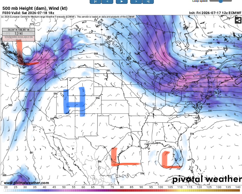
With our area being between low pressure systems, there won’t much if any large scale forcing for convection. While this will keep widespread and severe storms out of the picture we can’t rule out an isolated storm or two in the late afternoon or evening.
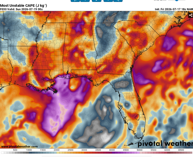
Strong instability will for very heavy rain, lightning, and maybe some strong downbursts. Most locations will remain dry however.
As hot as tomorrow will be it’s only gonna get worse.

The Day After Tomorrow
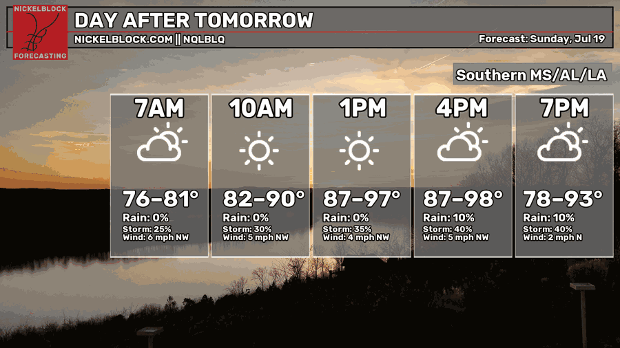
If the nights are steamy than the afternoons area saunas. Highs will likely hit the upper 90s without humidity. But with the humidity…
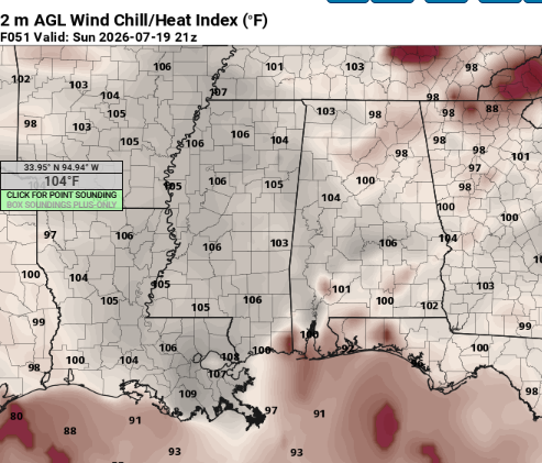
Air you can wear. Heat indexes may exceed 105. This is hot enough to be hazardous for anyone is exposed to it long enough. This is not a day to spend a lot of time doing yard work.
Rain chances will be minimal and skies will likely be mostly sunny. A day to wear some sunscreen and go swimming.
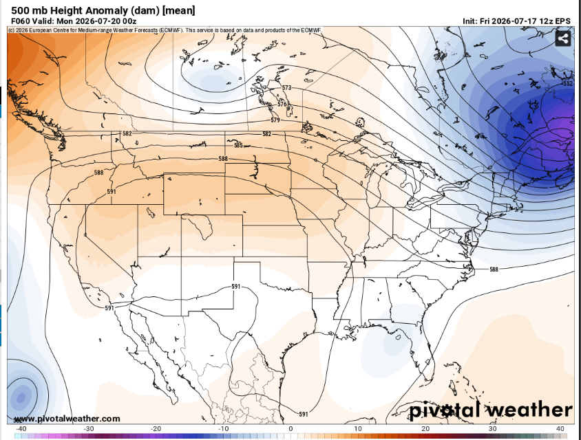
Interestingly, 500mb height anomalies are basically zero despite the intense heat. This shows that as bad as the heat is, it could definitely be worse.
When looking at heat related impacts, it often the duration of the heat that matters more than the magnitude. This is something to keep in mind as the pattern looks to stick around for a while.

Extended Outlook
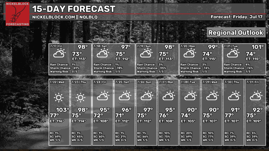
Yup, the heat is gonna be around for a bit. As the ridge builds into the region highs will be warmer than they’ve been all year. Overnight lows in the 70s will provide little relief (especially for outside animals). This will be a good stretch to stay inside and get stuff done versus spending times in the outdoors.
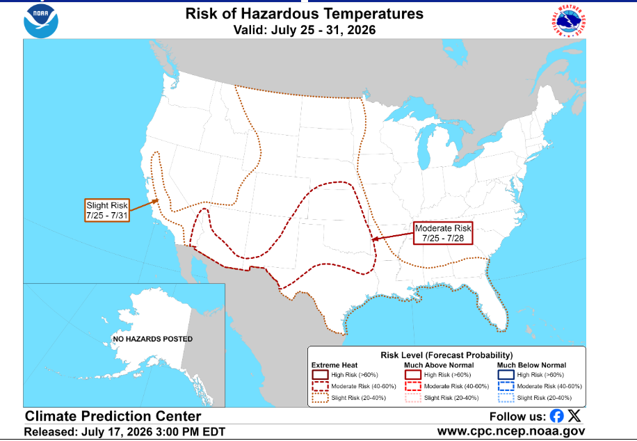
The Climate Prediction Center has outlined the entire Gulf coast at a slight risk for excessive heat. While highs may not be record breaking, the length of the heatwave will be very impactful.
Precipitation patterns are harder to decipher. As of now it looks to be pretty dry through early next week before rain chances slowly increase afterwards.
Day-By-Day Forecast
Tonight- Mostly clear with a low in the mid 70s. No rain but some fog is possible.
Tomorrow- Sunny with a high in the mid 90s. No rain.
Tomorrow Night- A slight chance of thunderstorms around sunset. Otherwise, Mostly clear with a low in the mid 70s. Some fog is possible.
Sunday- Sunny with a high in the upper 90s. Dry.
Sunday Night- Dry and mostly clear with a low in the mid 70s.
Monday- Sunny with a high around 100. No rain.
Monday Night- Isolated thunderstorms possible. Otherwise, mostly clear with a low in the mid 70s.
Tuesday- Increasing clouds with a chance of isolated thunderstorms. Highs in the low 100s.
Tuesday Night- Mostly clear with a low in the mid 70s. Dry.
Wednesday- Sunny and very hot with a high in the low 100s. No rain.
Wednesday Night- Dry and mostly clear with a low in the mid 70s.
Thursday- Afternoon thunderstorms possible. Mostly sunny with a high in the upper 90s.
Thursday Night- Mostly clear with a low in the mid 70s. No rain.


