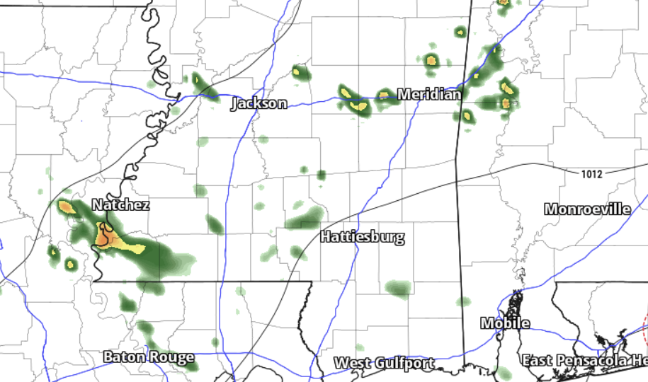
Today and tonight, we’re going to see a lot of different kinds of weather. This is cool. So! The early morning patchy fog will clear out early, giving way to sunshine and warm temperatures during the day. Then, this afternoon and evening, keep an eye out for scattered showers and storms. There isn’t a “good” chance for rain, but we are getting into the time of eyar where nearly every day has a shot for a brief shower.
Then overnight, things clear out and we should remain fog-free given some wind preventing fog formation.
Looking ahead to Tuesday through next Monday, things get a bit more interesting. A low-pressure system is on the move from the Northern High Plains towards the Great Lakes, bringing with it a cold front that’ll trigger storms across the general region by Tuesday afternoon. But I think we may have to wait a bit longer along and south of I-20. For us, I think Wednesday and Thursday, as the front slowly moves southward, we will finally get in on the showers and storms – including the potential for some stronger storms and some localized flash flooding.
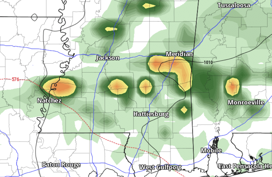
That said, there’s some uncertainty around the specifics of how things shake out so I’m not fully onboard with calling for a severe weather risk or specific flooding risk quite yet.
By Friday, things calm down and then over the weekend, expect quieter weather and cooler temperatures.
BIZ’CAST
Just a quick note, here, and not to get into your ‘biznass’ but if you own or run a business, I have been working on a way to help you out.
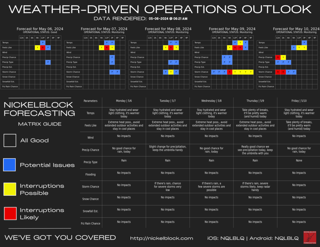
I’ve built a specialized weather prediction tool designed for businesses aiming to mitigate weather-related disruptions. Unlike traditional forecasts, it provides tailored insights specific to your location and business needs.
By analyzing a wide range of meteorological parameters, we offer a clear decision matrix based on preset thresholds, allowing you to anticipate weather impacts on your operations. Updated daily with a five-day outlook, this forecast empowers decision-makers to plan ahead efficiently. Utilizing advanced technology including machine learning and AI, our forecast ensures accuracy and reliability.
Whether it’s rain, snow, storms, or anything else Mother Nature can hurl at you, my goal is to provide businesses with actionable information to keep operations running smoothly.
REGIONAL DAY TO DAY FORECAST
Today: Passing clouds with highs around 90. A 20 percent chance for storms in the afternoon. South winds 5 to 10 mph.
Tonight: Mostly cloudy. Lows around 70. South winds 5 to 10 mph.
Tuesday: Partly sunny. A slight chance of showers and thunderstorms in the afternoon. Highs in the upper 80s. South winds 5 to 10 mph, increasing to around 15 mph in the afternoon. Chance of rain 20 percent.
Tuesday Night: Partly cloudy in the evening, then becoming mostly cloudy. Lows in the lower 70s. South winds 10 to 15 mph.
Wednesday: Mostly sunny. Highs around 90. South winds 15 to 20 mph with gusts up to 30 mph.
Wednesday Night: Partly cloudy in the evening, then becoming mostly cloudy. Lows in the lower 70s.
Thursday: Partly sunny. A chance of showers and thunderstorms in the afternoon. Highs in the lower 90s. Chance of rain 40 percent.
Thursday Night: Mostly cloudy with a chance of showers and thunderstorms. Lows in the upper 60s. Chance of rain 50 percent.
Friday: Mostly sunny. A chance of showers and thunderstorms, mainly in the morning. Highs in the mid 80s. Chance of rain 50 percent.
Friday Night: Mostly clear in the evening, then becoming partly cloudy. Cooler with lows in the upper 50s.
Saturday: Mostly sunny. Highs in the lower 80s.
Saturday Night: Partly cloudy. Lows in the upper 50s.
Sunday: Partly sunny. A slight chance of showers and thunderstorms in the afternoon. Highs in the lower 80s. Chance of rain 20 percent.


