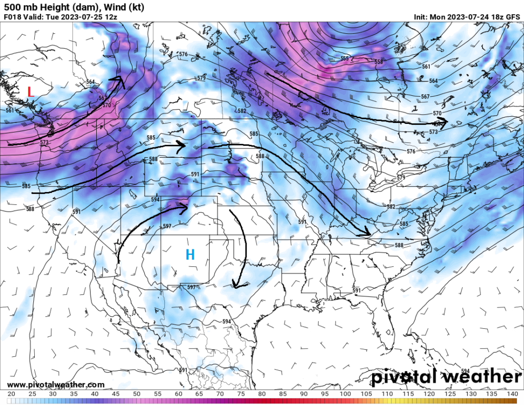
The heat will begin to slowly make a return across much of the Gulf coast and southeastern US through this week and into next week. A potent high-pressure system will begin to steadily progress eastward over the south central and southeast US, displacing any potential for organized storms further north away from our area. As a result, we will see temperatures gradually climb into the upper 90s and lower 100s by mid to late this week and early next week. Heat indices over this period will also begin to rise, possibly reaching the 105-110° mark. Our saving grace, at least temporarily, is that the typical presence of deep, rich, Gulf moisture is still punched out to the Gulf coast as a result of the cold front that went through a couple days ago. This will help keep the heat somewhat more bearable before the moisture makes a return by late this week and really brings back the oppressive air.
Short-Term Outlook
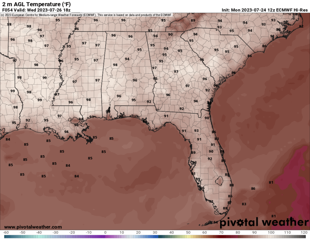
The aforementioned high-pressure system will creep over the area over the next couple of days, drying us out and steadily raising our temperatures. Daytime temperatures across the area will average between the mid to upper 90s and lows in the mid to upper 70s. Heat indices will stay relatively close to the actual air temperature due to the drier nature of the air, with relative humidity values only around 20-25%. In tandem with this increase in pressure over the region, low PW values (1.1-1.5 inches) and low dew point temperatures (55-60°F) will not allow for a favorable environment for the development of showers and thunderstorms as are typical this time of year.
Extended Outlook
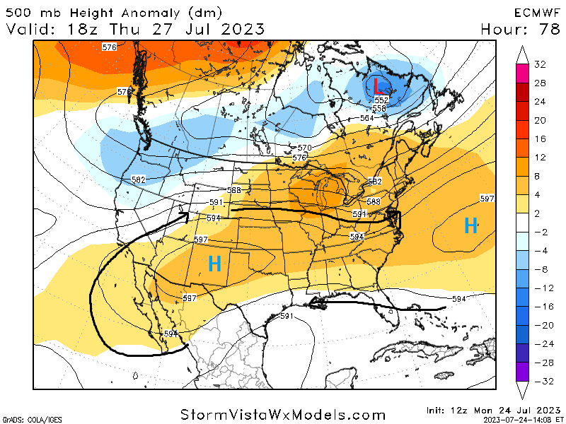
Late into this week and early next week, we will see largely the same conditions throughout the region with the exception being rich Gulf moisture will slowly make a comeback and add to the heat index, but also may help provide an outside chance of showers and thunderstorms along the coast. Temperatures by the end of the week and into next week look to reach into the upper 90s and low 100s for the majority of the area, with potential heat indices also climbing up to at least 105°F as dew point temperatures reach at least 70°F. This return of moisture will also help push PW values closer to 2 inches and provide a much moister atmosphere favorable for the development of at least a couple of showers by Friday. These showers and thunderstorms, if there are any, will likely be concentrated around the coast along the sea breeze front.
REGIONAL DAY-TO-DAY FORECAST
Today: Sunny. High temperatures in the low to mid 90s.
Tonight: Mostly clear skies. Low temperatures in the mid to upper 70s.
Wednesday: Sunny and hot. High temperatures in the mid to upper 90s. Heat indices may reach up to 100°F.
Wednesday night: Partly cloudy skies. Low temperatures in the mid to upper 70s.
Thursday: Mostly sunny and hot. High temperatures in the mid to upper 90s. Heat indices may reach up to 100°F.
Thursday night: Partly cloudy skies. Low temperatures in the mid 70s to low 80s.
Friday: Partly cloudy skies and hot. A stray shower or thunderstorm is possible. High temperatures in the mid to upper 90s. Heat indices may reach up to 103°F. Chance of rain 20%.
Friday night: Partly cloudy skies. A stray shower or thunderstorm is possible. Low temperatures in the upper 70s to low 80s. Chance of rain 20%.
Saturday: Mostly cloudy skies and hot. A stray shower or thunderstorm is possible. High temperatures in the mid 90s to low 100s. Heat indices may reach up to 105°F. Chance of rain 20%.
Saturday night: Partly cloudy skies. Low temperatures in the mid 70s to low 80s.
Sunday: Partly cloudy and hot. High temperatures in the upper 90s to low 100s. Heat indices may reach up to 105°F.
Sunday night: Mostly clear skies. Low temperatures in the upper 70s to low 80s.
Monday: Mostly sunny skies and hot. High temperatures in the upper 90s to low 100s. Heat indices may reach up to 110°F.
Monday night: Partly cloudy skies. Low temperatures in the upper 70s to low 80s.


