Hurricane Bonnie continues to move westward off into the Pacific Ocean, posing no threat to the mainland US. Off to its southeast, a cluster of thunderstorms is expected to turn into a tropical depression within the next 5 days. Over on the Atlantic side of things, no organized tropical development is currently anticipated at this time.
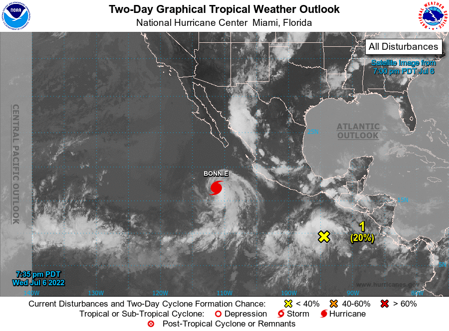
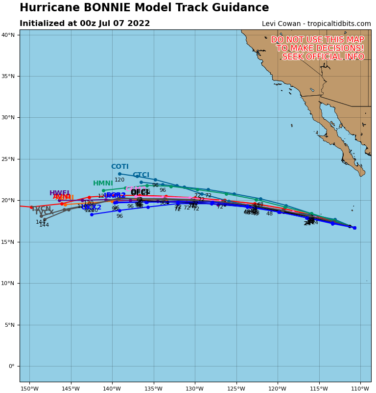
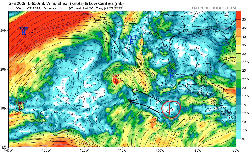
As of 11:00pm CDT, Hurricane Bonnie remains a Category 2 hurricane in the eastern Pacific and continues to move off into open waters. Behind it, a group of thunderstorms (area 1) is expected to slowly move off to the west-northwest.
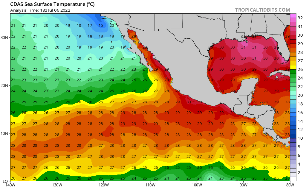
These storms will begin to organize as it interacts with warm sea surface temperatures (above 26°C) and low wind shear aloft. Organization into a tropical depression is probable over the next 5 days, but this storm looks to stay over open waters at this time.
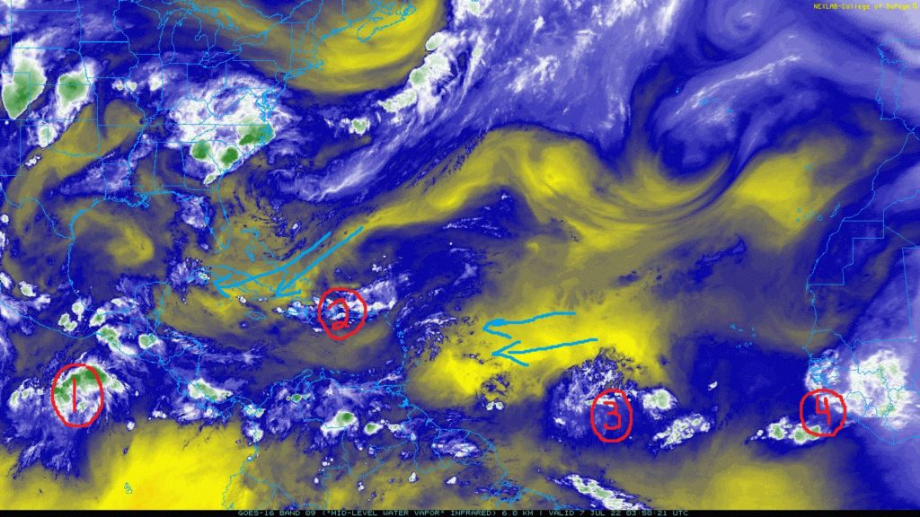
Over in the Atlantic, several groups of disorganized thunderstorms are present from Puerto Rico to just off the coast of West Africa (areas 2, 3, and 4). These storms are currently at this time not expected to become organized in the next 5 days.
Dry air intrusion from the north will keep these storms surrounded by stable air, preventing intensification. Along with this, high wind shear aloft in the upper levels will prevent any attempt at organization by shearing convection apart before it can get itself together.
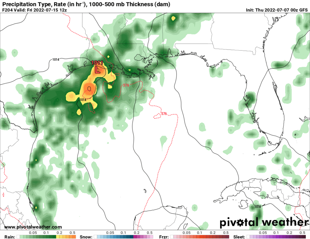
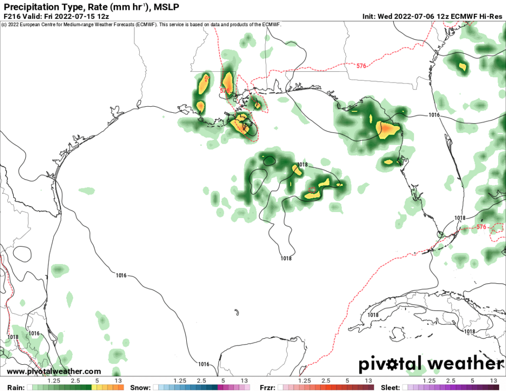
Over the next week, the Atlantic basin, conditions will remain unfavorable for tropical development at this time, with continued dry air coming off of western Africa and strong wind shear aloft helping to suppress any organized development. Conditions in the Gulf of Mexico are slightly more apt for storm development, with more relatively moist air being prevalent and slightly less wind shear. The GFS model does try to display some kind of development in the Gulf late next week, but the Euro is still devoid of anything organized occurring.