Following last night’s dense fog after the cold front passed through, we’ll see another chance for some fog overnight into the morning, however we’ll be a bit on the warmer side tonight with temperatures in the upper 50s to low 60s. That’s a pretty good indicator for how much warmer we’ll get over the next couple of days with highs jumping back into the 70s after our couple of more wintry feeling days. The fog should last until around 9am and lift with mixed clouds and sun to happen during the daytime.

One more round of patchy fog will hang around as the winds shift to the southwest overnight on Sunday. Come the start of the week, we’ll be back in another humid pattern with some rain possible during the day. The subtropical jet at the surface will help pull some Gulf moisture to most of south Louisiana and Mississippi with south winds at the surface and a trough in the upper levels pushing the storms to the east. Most of the severe weather will occur around southwest to northwest Louisiana and parts of southwestern Mississippi with some hail and strong winds possible during the afternoon. Some showers will be possible further east into the Pinebelt and around the coastline as well.
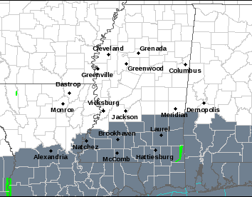
Dense fog is possible through most of southern LA/AL/MS overnight into the morning on Sunday. Expect temperatures to climb into the 70s for the next couple of days as the subtropical jet sets up. We’ll see partly sunny skies on Sunday and increasing clouds overnight into Monday as the rain moves in.
[wpcode id=”41179″]
Regional Day-to-Day Forecast
Tonight – Patchy fog after midnight. Otherwise, mostly cloudy, with a low in the upper 50s to low 60s. Calm wind.
Sunday – Areas of fog before 10am. Otherwise, partly sunny, with a high in the mid 70s. Calm wind becoming south southeast around 5 mph in the morning.
Sunday Night – Patchy fog after midnight. Otherwise, mostly cloudy, with a low around 60. South southeast wind around 5 mph.
Monday – A 40 percent chance of showers and thunderstorms, mainly in the afternoon. Patchy fog before 9am. Otherwise, cloudy, with a high in the mid 70s. South southeast wind 5 to 10 mph.
Monday Night – Showers and thunderstorms overnight. Low in the low 60s. Southeast wind 5 to 10 mph. Chance of precipitation is 80%. New rainfall amounts between three quarters and one inch possible.
Tuesday – Showers and thunderstorms, mainly before noon. High in the low 70s. East southeast wind 5 to 10 mph. Chance of precipitation is 80%. New rainfall amounts between three quarters and one inch possible.
Tuesday Night – A 20 percent chance of showers and thunderstorms before midnight. Mostly cloudy, with a low in the upper 50s. East southeast wind around 5 mph becoming northwest after midnight.
Wednesday – A 20 percent chance of showers. Partly sunny, with a high in the low 70s. North northwest wind 5 to 10 mph.
Wednesday Night – Mostly cloudy, with a low in the mid 50s. North northwest wind 5 to 10 mph becoming east northeast after midnight.
Thursday – A 40 percent chance of showers after 10am. Mostly cloudy, with a high in the mid 70s.
Thursday Night – Rain likely and possibly a thunderstorm. Cloudy, with a low around 60. Chance of precipitation is 60%.
Friday – Showers and thunderstorms likely. Cloudy, with a high in the low 70s. Chance of precipitation is 70%.
Friday Night – A 50 percent chance of showers and thunderstorms. Mostly cloudy, with a low in the mid 50s.
Saturday – A 30 percent chance of showers. Partly sunny, with a high near 70.
[wpcode id=”41149″]


