While it’s quiet in the south, a very active severe weather day is likely across the Midwest with intense tornadoes, hurricane force winds, and widespread flooding all likely. This is due to a significant mid level trough ejecting across the region. This is also the reason why it’s so calm and hot down here.
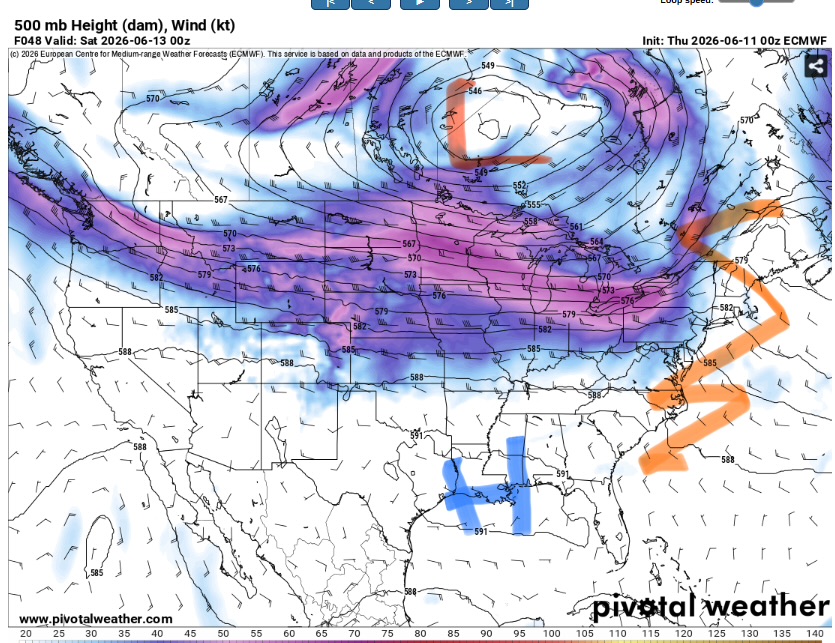
The jet will sink south over the coming days towards the Gulf by early next week. That may allow for a slight increase in severe weather potential (mainly for damaging winds) but it probably won’t be anything major. The main story will be the risk for repeated rounds of heavy rain and flooding as the front stalls across the region. This will also help moderate the temperatures given the excess cloud cover.

Tonight
It should be a calm night. Temperatures will bottom out in the low to mid 70s. There may be a chance for some isolated areas of patchy fog. This is due to the absence of strong surface winds and the potential for high relative humidity as the temperature drops to close to the dew point.
Make sure to drive slow in areas fog (and watch out for deer). Some upper level cirrus may migrate into the area which may mitigate the fog threat a little bit.
No precipitation will occur but it will definitely feel muggy.
Tomorrow
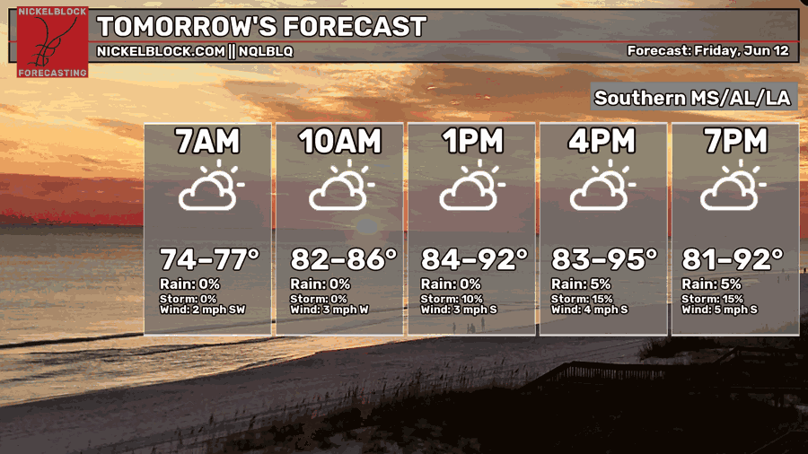
Gross. Gross Gross.
It ain’t gonna rain but you’re probably gonna wish it would.
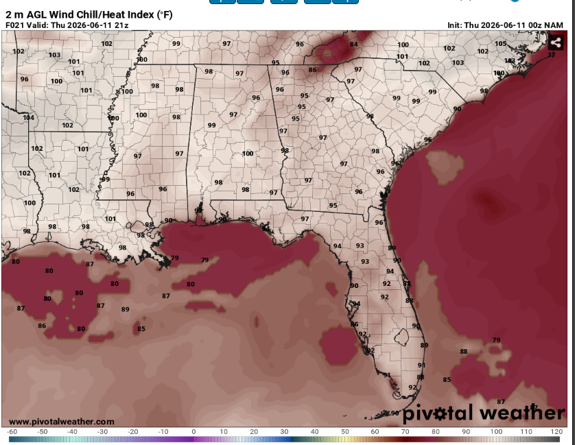
Heat indexes will peak above 100 degrees. Make sure to drink plenty of water and take frequent breaks if you must be outside. The dew point will be in the mid 70s and combined with highs in the mid 90s, it will be a great day to go swimming (and that’s about it).
The lack of precipitation chances and hot temperatures are due to the position of the jet stream. With it stationed so far north of us, there is no lift or shear to support convection. Instead, hot air sinks to the surface keeping us locked in a sweltering regime.
Surface winds will also be very light, keeping heat relief minimal and potentially allowing for some early morning fog.

The Day After Tomorrow
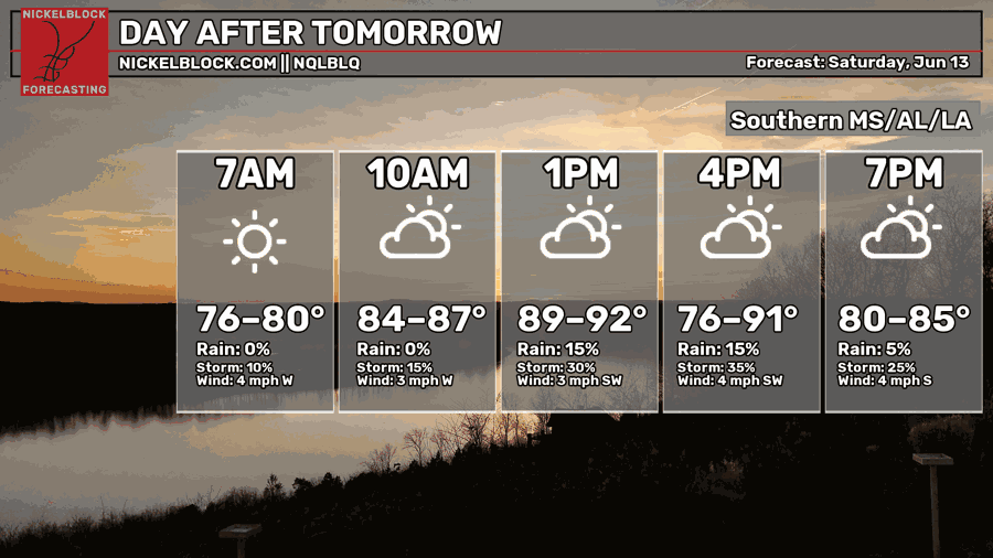
More sun = more heat.
Yet another day of hot conditions for our area. The National Weather Service has issued a heat advisory for western Mississippi and eastern Louisiana valid from tomorrow at 11am through Saturday at 8pm. This means that is an increased risk for heat related ailments to both people and animals. Wear loose fitting clothing stay out of the sun if you most be outside.
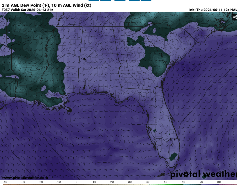
Interestingly enough, some models (the NAM) is shown above) predict that the dewpoints will mix out in the afternoon. This would mean that the relative humidity would drop but the actual temperature would increase. The result is the same either way: it will be very unpleasant with potentially dangerous heat for sensitive groups or those exposed for too long.
As is typical this time of year, We can’t completely rule out an isolated pulse thunderstorm but it is very unlikely due to the lack of large scale forcing. If one were to occur, the main hazards would be very heavy rain and frequent cloud to ground lightning.

Extended Outlook
As stated above, the jet stream is expected to sink south by early next week. This will give our area the necessary lift to provide support for more widespread rain and thunderstorms. Severe weather chances appear on the lower side but far from zero. The most likely scenario would be a slow moving front triggering multiple, loosely organized convective clusters across the south.
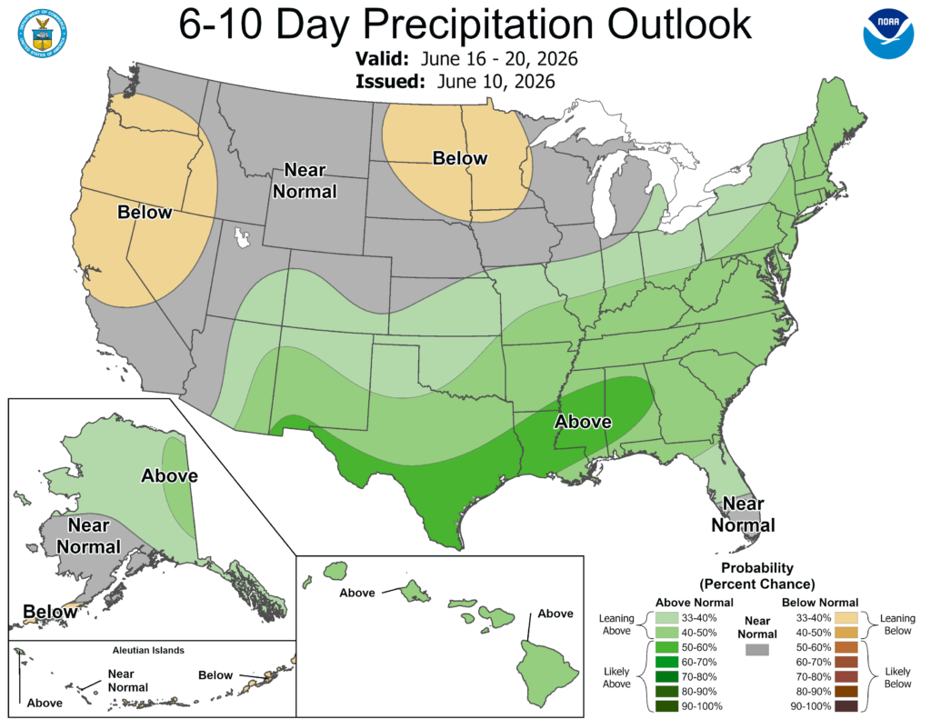
There would likely be a low end threat for damaging winds but likely nothing crazy. The main threat however, would be flooding. Given several days of numerous thunderstorms, soils may become too saturated to fully absorb all the runoff. Check back for updates as this pattern approaches.
Temperatures should be fairly seasonal. Some days may slightly cooler than average if thunderstorms block out the sun, but the humidity will make up for it in that case.
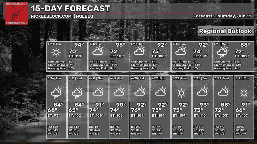
Day-By-Day Forecast
Tonight – Mostly clear with a low in the lower 70s. No rain.
Tomorrow – Mostly sunny and hot with a high in the mid 90s. Dry.
Tomorrow Night – Partly cloudy with a low in the mid 70s. No precip expected.
Saturday – Partly sunny and hot with a high in the mid 90s. There may be an isolated storm or two in the area but most area will be dry.
Saturday Night – Mostly clear with a low in the mid 70s. No rain.
Sunday – Partly sunny with a chance of afternoon thunderstorms. High in the mid 90s.
Sunday Night – Partly cloudy with a chance of scattered thunderstorms. Low in the mid 70s.
Monday – Widespread thunderstorms likely. Partly sunny with a high in the upper 80s.
Monday Night – Widespread showers and storms likely. Low in the lower 70s and mostly cloudy.
Tuesday – Numerous showers and thunderstorms. High around 80 with mostly cloudy skies.
Tuesday Night – Showers and thunderstorms likely. Mostly cloudy with a low around 70.
Wednesday- Showers and thunderstorms likely. High in the mid 80s and mostly cloudy.
Wednesday Night – Chance of scattered showers and thunderstorms. Mostly cloudy with a low around 70.


