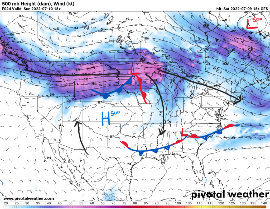
Upper-level ridging continues over the western U.S. leading to extreme heat in the Northern and Southern Plains. On the northern side of the ridge, severe weather is expected over North Dakota and Northern Minnesota as well as thunderstorms for the Southeast. Two sets of frontal systems will be responsible for those storms. Monsoon season is kicking off over the Southwest with flooding concerns.
Severe Weather
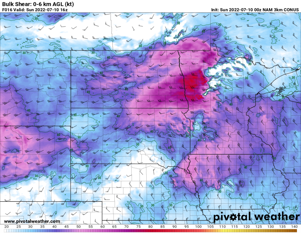
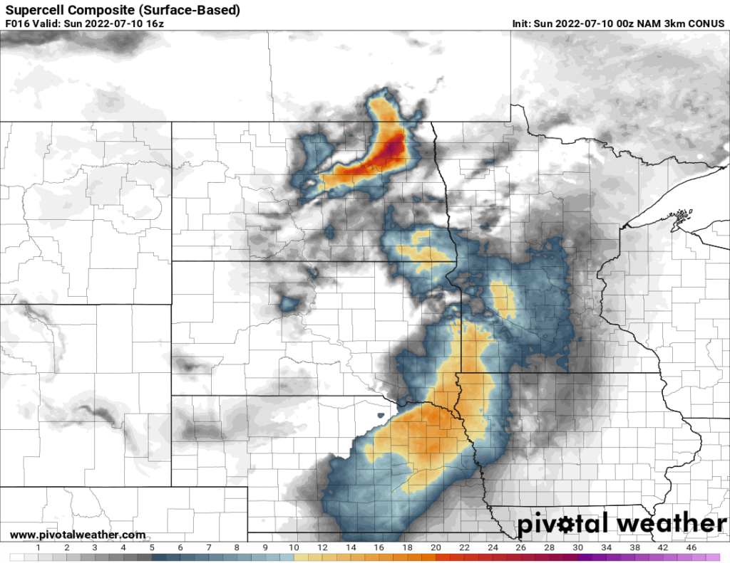
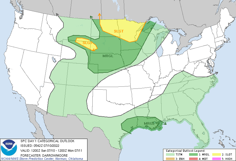
Early Sunday morning a mesoscale convective system will trek across North Dakota into Northern Minnesota along with a surface low as seen on the map above. This system will weaken some but not completely by Sunday night. Storms are also expected to fire off in the wake of this system in the same region. Shear is expected in the environment to aid in the development of supercells. This is mirrored in SPC’s 5-percent probability of a tornado within 25 miles of a point in Northeastern Minnesota. However, the main threats from these storms will be strong wind gusts and large hail. This is encompassed in the SPC outlook for Sunday.
In addition to the slight risk on the Upper Mississippi Valley, the SPC’s outlook for Sunday outlines a marginal risk for SE Texas and southern Louisiana. Northwesterly flow will bring the frontal boundary in the region to provide lift for storms to pop off. Strong daytime heating exists with temperatures reaching the upper 90s and even 100F in Texas coupled with a very moist airmass trapped by the front. The main threat here will be severe wind gusts from the stronger storms’ downdrafts.
The Southeast will also see scattered showers and storms from the frontal boundary associated with daytime heating to initiate convection.
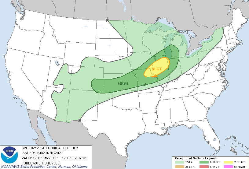
For Monday, the cold front from the surface low from North Dakota Sunday will moves southeastward in the Mid-Mississippi Valley. Storms associated with this have the potential to support severe wind gusts and even hail. Storms could organize into a squall line as they pass to increase the wind damage.
CONUS Temperature Outlook
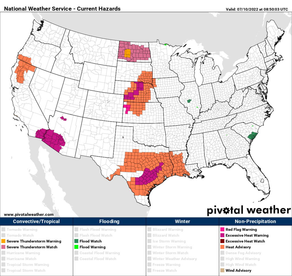
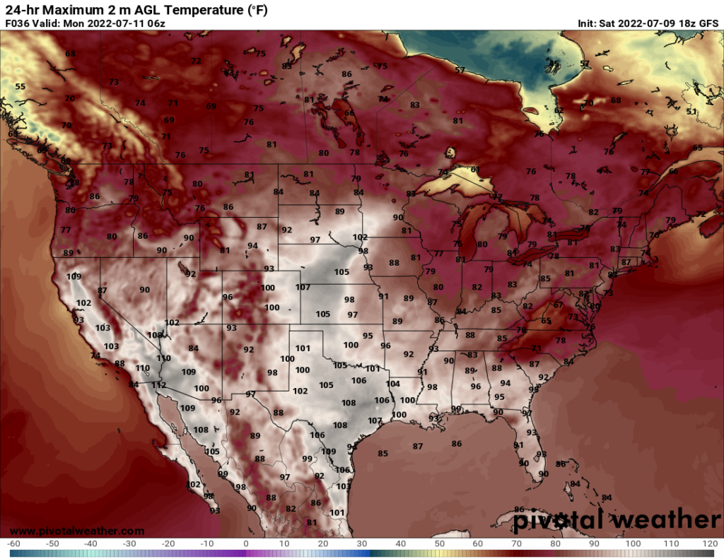
With the upper-level ridge over the Western U.S., temperatures in the center of the country will see extreme heat. In Texas, high temperatures are expected to reach up to 108F with heat indices ranging between 108F and 112F. Heat advisories and warning are in place for Sunday.
In the Central Plains, temperatures will reach past 100F with heat indices up to 108F. Increasing humidity in the area meets the criteria for heat advisories and warnings as well. Southwest Arizona will also see temperatures reaching past 100F.
As always, stay hydrated when outdoors for prolonged periods. Take breaks from the heat in air conditioning and look after at risk relatives and friends. Learn more about heat safety and resources from the NWS here.
Towards the back half of the week, the ridge over the West will strengthen a bit bringing temperatures near 100F to the Central U.S., SW Arizona and Southern California. These places will have to look out for heat advisories and warnings from their local NWS office. As the west braces for the heat, the Great Lakes region and the Northeast get a bit of a cooldown. An upper-level trough will bring a mild cold front through the area Wednesday into Thursday.
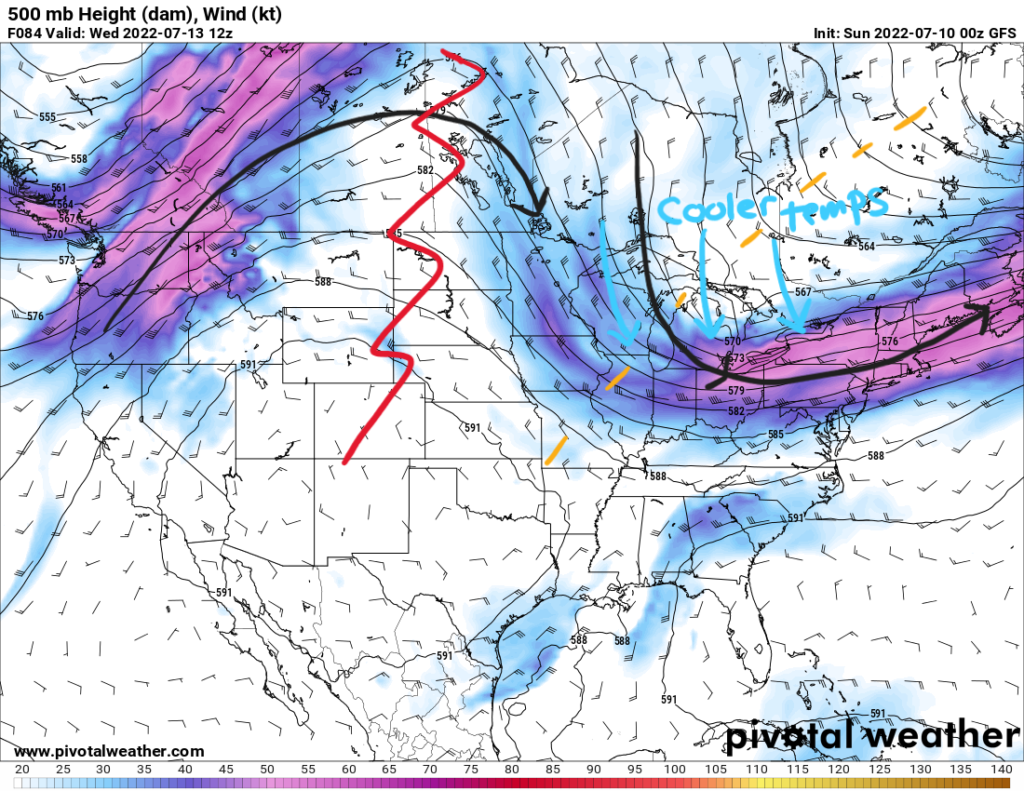
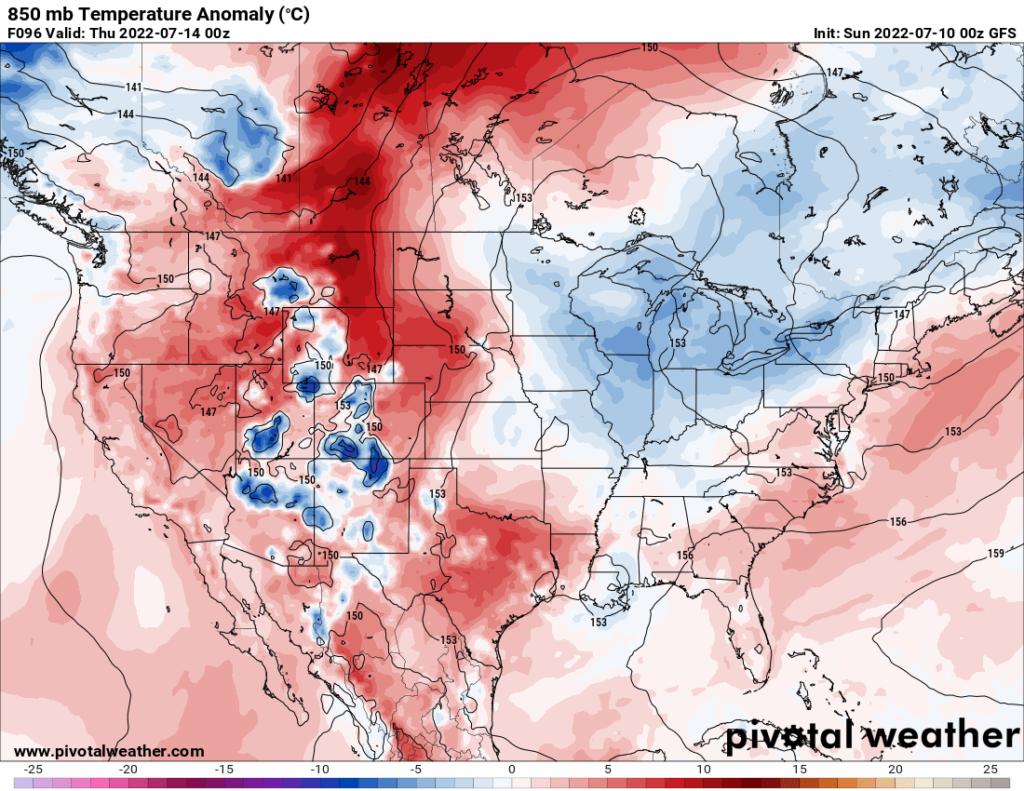
Overnight lows will be in the 50s Wednesday night into early Thursday morning before diurnal heating brings the temperature up to only the 70s across the region. This can be seen below in the mid-level temperature anomaly with cooler than normal temperatures overnight Wednesday.
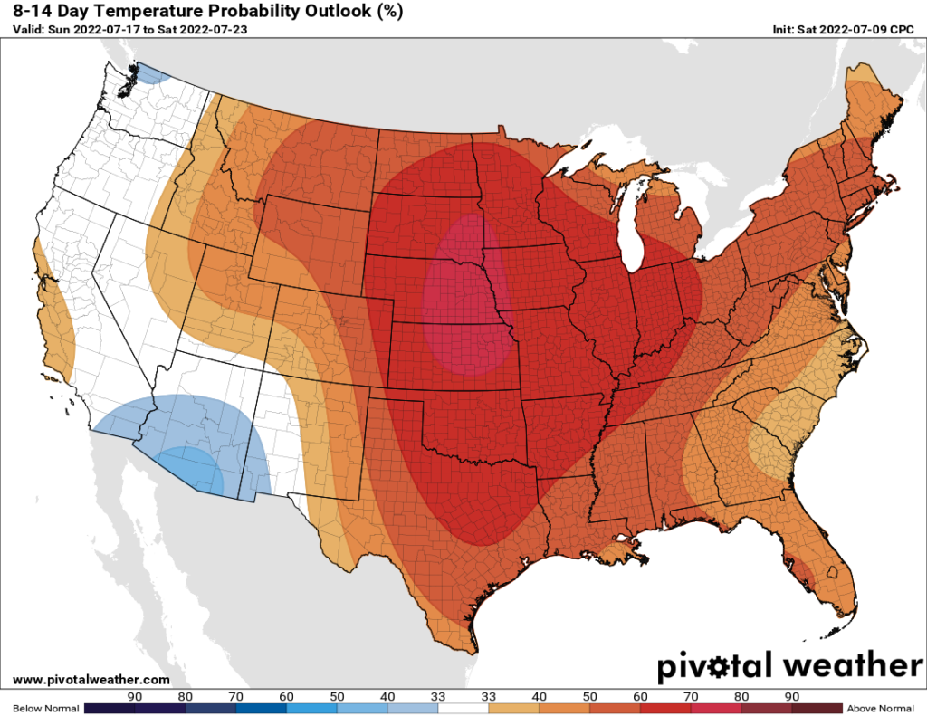
This does not seem to last for long as the ridge attempts to build back to the east by next Sunday. This will cause temperatures to increase once again towards the central and eastern side of the country. The 8-14 day outlook shows this side of the country with a 50-percent or more probability for above average temperatures.
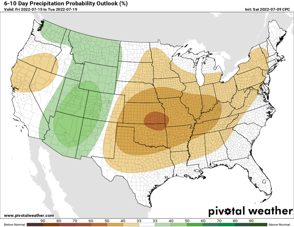
Southwestern Monsoon
The Southwest is on tap to receive some much needed rain after months of drought and wildfires. Monsoonal rains will ramp up from an increase in moisture content due to the high pressure ridge bringing a subtropical airmass up on the western side of it. Slow moving showers and storms could prove to be a flood risk as recent burn scars can be prone to flash flooding.
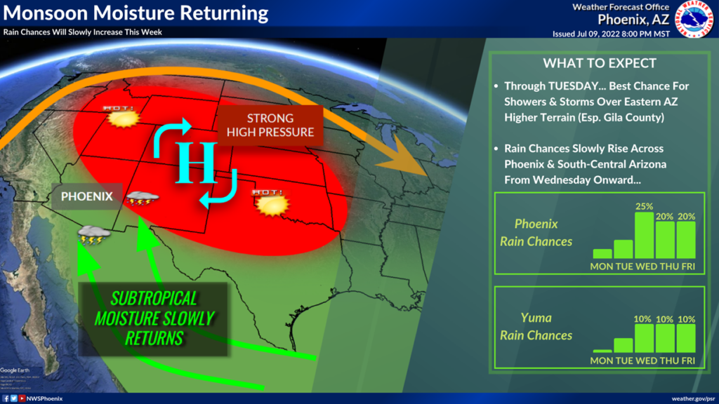
This pattern will continue for a while. The Weather Prediction Center has the four corners region in a marginal risk (1/4) for excessive rainfall for the next three days. Into the weekend and early next week, there is an above average probability for precipitation.