The forecast indicates a continuation of quiet weather conditions for today, attributed to the slow eastward migration of the upper ridge and surface high. However, a Dense Fog advisory remains in effect until 9 AM for parts of the area.

Afternoon temperatures are expected to peak in the low 80s, accompanied by calm conditions and rising moisture levels. Cloud cover will progressively increase from the west later in the day and into the evening, inhibiting radiational cooling tonight which should limit the threat for fog.
Moving toward the weekend, we will be situated on the northern periphery of an upper ridge extending from the Gulf of Mexico to the Caribbean Sea. Persistent westerly zonal flow, coupled with a stationary frontal boundary sagging southward, will result in multiple rounds of rain and storms.
There’s a possibility of isolated severe storms during this period. High temperatures on Friday are forecasted to reach the mid to upper 80s before gradually cooling down over the weekend. Low temperatures will start in the low to mid 60s early on, potentially dropping to the mid to upper 50s by Sunday morning.
REGIONAL DAY TO DAY FORECAST
Today: Patchy fog this morning. Mostly sunny. Highs in the lower 80s. South winds 5 to 10 mph.
Tonight: Partly cloudy in the evening, then becoming mostly cloudy. Lows in the lower 60s. South winds 5 to 10 mph.
Tuesday: Patchy fog in the morning. Partly sunny. Highs in the lower 80s. South winds 15 to 20 mph with gusts up to 30 mph.
Tuesday Night: Mostly cloudy. Lows in the mid 60s. South winds 10 to 15 mph with gusts up to 25 mph.
Wednesday: Mostly cloudy. Highs in the lower 80s. South winds 10 to 15 mph with gusts up to 25 mph.
Wednesday Night: Mostly cloudy. Lows in the mid 60s.
Thursday: Mostly cloudy. Highs in the mid 80s.
Thursday Night: Mostly cloudy. Lows in the mid 60s.
Friday: Mostly sunny. Highs in the upper 80s.
Friday Night: Partly cloudy in the evening, then becoming mostly cloudy. Lows in the mid 60s.
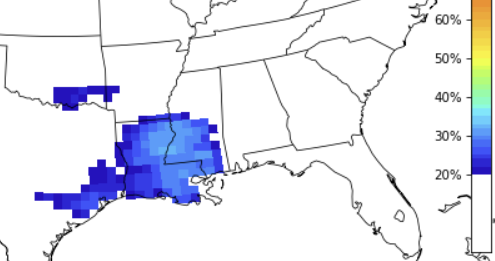
Saturday: Mostly sunny. A slight chance of showers and thunderstorms in the afternoon. Highs in the upper 80s. Chance of rain 20 percent.
Saturday Night: Partly cloudy in the evening, then becoming mostly cloudy. Lows in the lower 60s.
Sunday: Partly sunny in the morning, then becoming mostly cloudy. A chance of showers. A slight chance of thunderstorms in the morning, then a chance of thunderstorms in the afternoon. Highs in the upper 70s. Chance of rain 40 percent.


