To borrow a line: All’s Quiet on the Western Front. Right now the forecast doesn’t include any major weather moving into the area during the next few days. We will eventually get back into a shot for showers and storms, but we have a few days to get there.
The rest of this week looks nice and the weekend looks equally pleasant. I think we may see a few wayward showers or storms on Sunday. Not enough of a potential, though, to cancel any outdoor plans. Just maybe have a backup plan to duck inside for 20-30 minutes while any shower may pass.
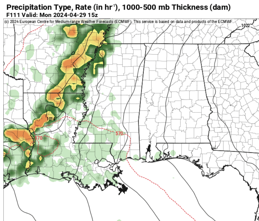
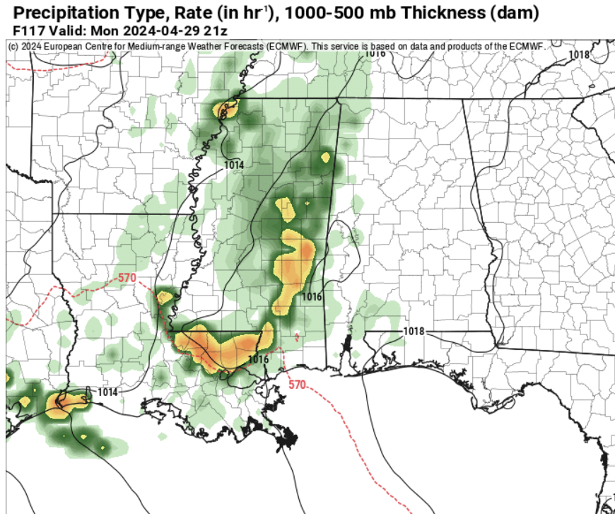
Then Monday I think we finally get another shot for rain as an MCS slides through the area, diving toward the Gulf. The cluster of storms will be falling apart as it does so, so there is a good shot that a handful of us (closer to the coast and into Alabama) don’t actually see any rain at all from this thing – but I think there is a good enough shot for the rest of us that it warrants attention.
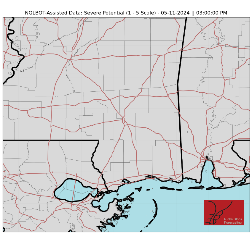
Looking at the NQLBOT-assisted data, it look slike the severe potential on Monday afternoon is pretty low.
That said, storms may be rather rowdy as it cruises toward the coast with heavy rain, lightning, wind gusts up to 50mph, and some small hail. The tornado threat should be quite low.
REGIONAL DAY TO DAY FORECAST
Today: Patchy fog this morning. Mostly sunny. Highs in the mid 80s. Northeast winds around 5 mph, becoming south this afternoon.
Tonight: Partly cloudy in the evening, then becoming mostly cloudy. Patchy fog after midnight. Lows around 60. South winds around 5 mph.
Friday: Patchy fog in the morning. Partly sunny. Highs in the lower 80s. Southeast winds 10 to 15 mph with gusts up to 25 mph.
Friday Night: Mostly cloudy. Lows in the mid 60s. Southeast winds 10 to 15 mph.
Saturday: Mostly cloudy in the morning, then becoming partly sunny. Highs in the lower 80s. Southeast winds 15 to 20 mph with gusts up to 35 mph.
Saturday Night: Mostly clear. Lows in the mid 60s.
Sunday: Mostly sunny with a shower or storm here or there. Highs in the lower 80s. Chance of rain around 10 percent.
Sunday Night: Mostly clear in the evening, then becoming partly cloudy. Lows in the mid 60s.
Monday: Mostly sunny. A slight chance of showers and thunderstorms in the afternoon. Highs in the mid 80s. Chance of rain 40 percent.
Monday Night: Partly cloudy in the evening, then becoming mostly cloudy. Lows in the mid 60s.
Tuesday: Partly sunny. Highs in the mid 80s.
Tuesday Night: Partly cloudy. Lows in the lower 60s.
Wednesday: Mostly sunny. Highs in the upper 80s.


