Hello everyone, there will be storms starting to develop in the Gulf of Mexico that starting to come up to the coast in the afternoon. In the morning it will be sunny with few clouds, but more clouds will start to roll in the coast with stormy weather coming to the coast in the afternoon and evening. The low temperature will be at low 70s and the high temperature will be at upper 80s to low 90s for today. The dew points will be in the low 70s to mid 70s for today.
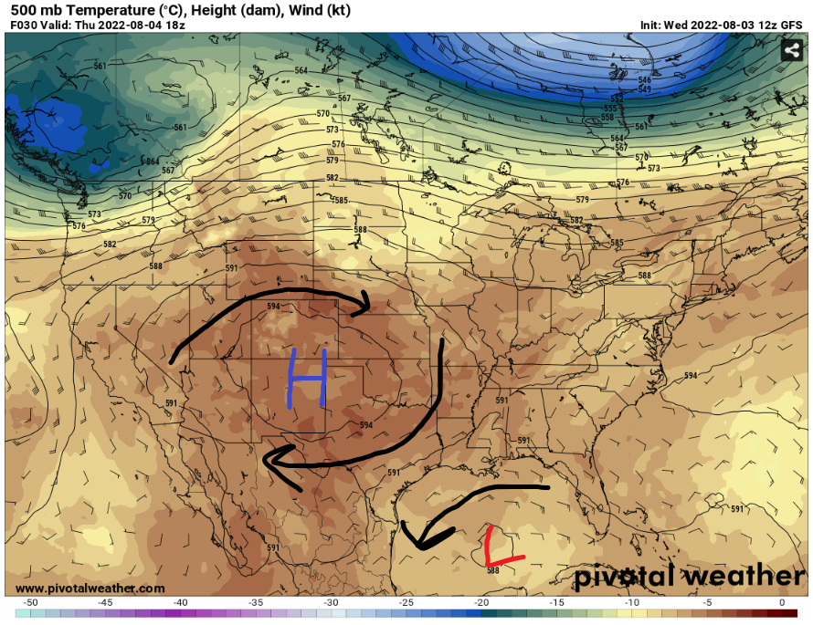
The low pressure will be staying in the Gulf of Mexico to produce storms near the coast. It will be staying in the Gulf of Mexico for the next few days with occasional showers and thunderstorm in the coast. For the rest of the week, the high-pressure system in the west will stay near the Four Corner states. It will slowly move east in the next few weeks for hotter weather.
With the low pressure staying in the Gulf of Mexico, the showers and thunderstorm will reach up to the coastal LA/MS/AL. It seems like the storms will be moving from east to west from the low-pressure spin. The coastal Mississippi and Alabama will be having some rain in the early afternoon then the storms will travel to coastal Louisiana in the late afternoon and evening.
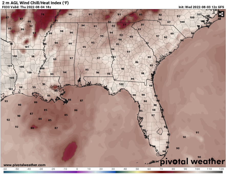
With the storms coming in the coast, it means the temperatures will be slightly cooler. The heat index values will be around low 90s to mid 90s for the coast.
Day to Day Forecast
Thursday
Sunny in the morning with a 60-percent for widespread showers and thunderstorms developing in the afternoon. The high temperature will be in the upper 80s. The heat index values will be in the low 90s to mid 90s.
Friday
Partly cloudy in the morning with a 40-percent of scattered showers and thunderstorms developing in the afternoon. The high temperature will be in the upper 80s. The heat index values will be in the mid 90s.
Saturday
Partly cloudy in the morning with a 50-percent of scattered showers and thunderstorms developing in the afternoon. The high temperature will be in the upper 80s. The heat index values will be in the upper 90s.
Sunday
Partly cloudy to mostly cloudy in the morning with a 60-percent of scattered showers and thunderstorms developing in the afternoon. The high temperature will be in the upper 80s. The heat index values will be in the mid 90s.
Monday
Partly cloudy in the morning with a 60-percent of scattered showers and thunderstorms developing in the afternoon. The high temperature will be in the upper 80s. The heat index values will be in the upper 90s.
Tuesday
Partly cloudy in the morning with a 70-percent of scattered showers and thunderstorms developing in the afternoon. The high temperature will be in the upper 80s. The heat index values will be in the low 90s.
Wednesday
Partly cloudy in the morning with a 60-percent of scattered showers and thunderstorms developing in the afternoon. The high temperature will be in the upper 80s. The heat index values will be in the mid 90s.


