Enjoy tomorrow and soak up the sun…but not too much, as heat indices could soar to 107 degrees! Conditions change on Sunday, marking the beginning of a rainy stretch that will last through Tuesday.
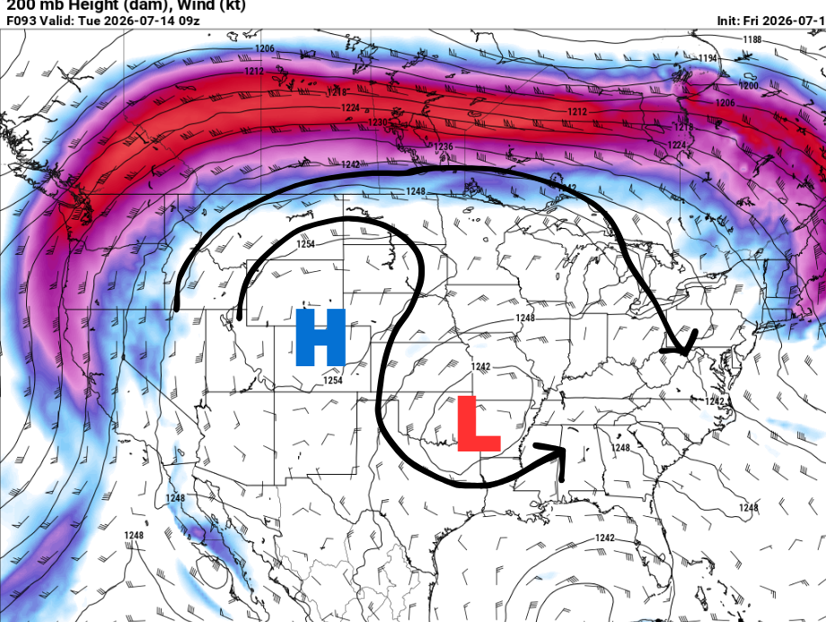
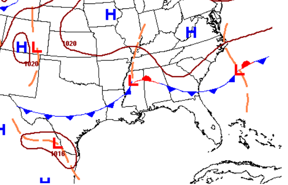
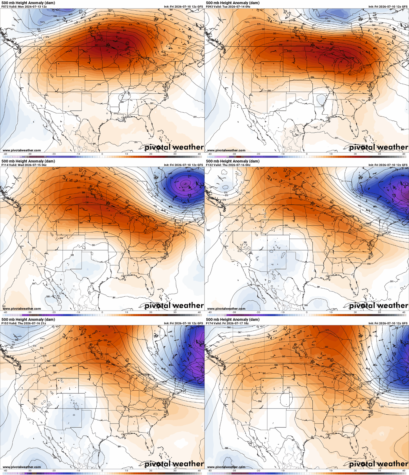
Early next week, a Rex block looks to take place, which is a pattern characterized by a high-pressure system located north of a closed low in the upper levels of the atmosphere (above, left). Meanwhile, down at the surface, a low-pressure system and cold front are forecasted to be in place near Mississippi (above, right).
The difference between these two areas of low pressure pictured above, is that they occur at different heights in the atmosphere and play different roles. While the surface low is responsible for bringing the rain, the upper-level low gives a boost and provides extra lift that helps enhance the storms below, resulting in more widespread showers and thunderstorms.
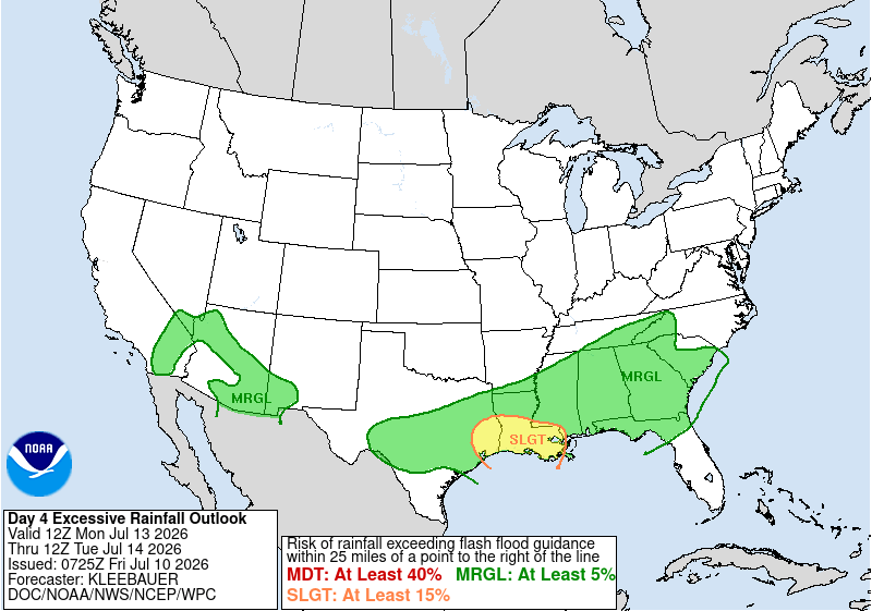
Taking a peek at Monday, as expected, the Weather Prediction Center already has southern Louisiana under a Slight Risk for excessive rainfall. Numerous to widespread showers and thunderstorms will occur during the Sun–Tues timeframe, with isolated flash flooding possible.

TONIGHT
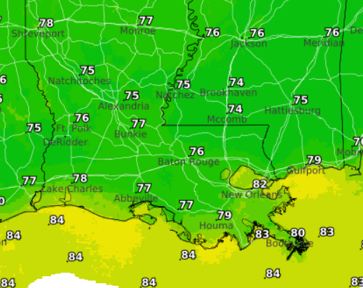
Lingering storms possible until sunset near Jackson before skies become mostly clear overnight. Lows will range from 74 near Brookhaven to around 80 near Houma. Winds will be light out and blowing from the south.
TOMORROW
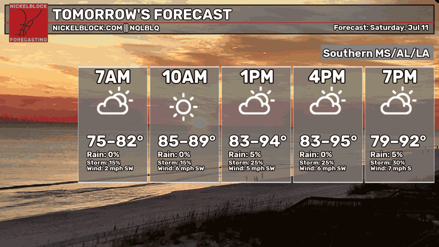
Saturday, heat is the main story. Highs will be near 95, but the humidity will make it feel closer to 105. Expect a very typical hot summer day with a mix of sun and clouds, along with isolated afternoon and evening storms.
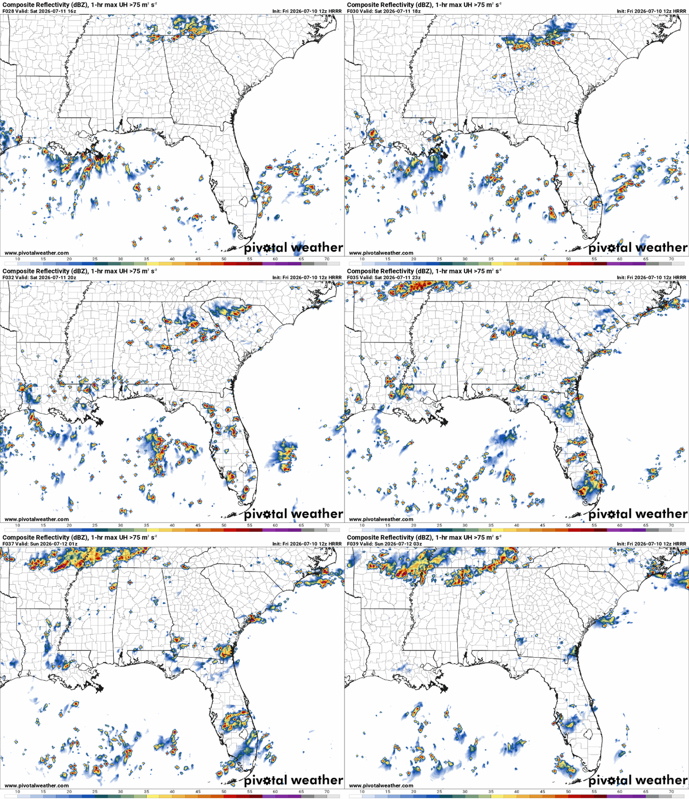
Storms will develop near the coast during the morning before shifting farther inland through the afternoon. The main hazards will be locally heavy rainfall, frequent lightning, and gusty sub-severe winds of 40–50 mph.
The highest rain totals are expected across southeastern Louisiana. Meanwhile, it looks mostly dry and hot for those near Jackson, Brookhaven, and Meridian, where heat index values could reach 110.

THE DAY AFTER TOMORROW
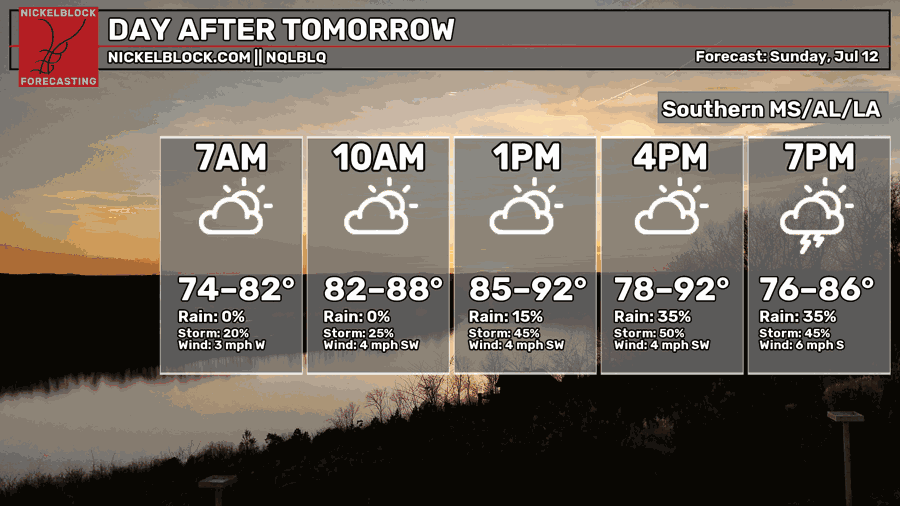
Sunday marks the beginning of a more active, rainy weather pattern. As a weak surface low begins to sink south, it will provide the lift needed for numerous to widespread showers and thunderstorms to develop. The highest precipitation totals are expected near coastal Louisiana.

EXTENDED OUTLOOK
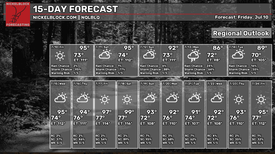
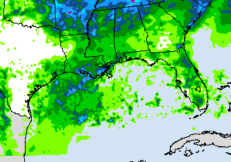
Widespread showers and thunderstorms will continue through Tuesday due to the close proximity of the low-pressure system. Then, we begin to return to our typical summertime pattern on Wednesday as high pressure rebuilds over the region, as shown below.
DAY-BY-DAY FORECAST
Tonight – Lingering storms possible until sunset near Jackson before skies become mostly clear overnight. Lows will range from 74 near Brookhaven to around 80 near Houma. Winds will be light out and blowing from the south.
Saturday – Saturday, heat is the main story. Highs will be near 95, but the humidity will make it feel closer to 105. Expect a very typical hot summer day with a mix of sun and clouds, along with isolated afternoon and evening storms. Rain chance: 50%
Saturday Night – A few showers and storms may linger overnight under mostly clear skies. Low around 74. South wind around 5 mph. Rain chance: 20%
Sunday– Numerous to widespread showers and thunderstorms likely, mainly in the afternoon. Highs around 92. Southwest wind 5mph. Rain chance: 70%
Sunday Night – Showers and thunderstorms continue overnight. Otherwise, cloudy with a low near 73. Calm wind. Rain chance: 50%
Monday – Numerous showers and thunderstorms likely, with the potential for localized flooding. Cooling down with a high near 86. Winds around 5mph blowing from the west. Rain chance: 90%
Monday Night – Showers and thunderstorms possible overnight, otherwise cloudy with a low around 72. Southwest wind around 5 mph. Rain chance: 40%
Tuesday – Wet weather hangs around with numerous showers and thunderstorms possible. Otherwise, mostly cloudy, with a high near 89. Calm southwest wind 5 mph. Rain chance: 70%
Tuesday Night – Some showers could linger into the early overnight hours before settling into mostly cloudy night. Lows around 70. Winds blowing from the west at 5mph. Rain chance: 20%
Wednesday – Drier weather returns finally. Mostly sunny skies with isolated afternoon and evening storms possible. Highs near 95. Rain chance: 30%
Wednesday Night – A stray evening shower remains possible before skies settle into a partly cloudy night. Low around 74. Rain chance: 15%
Thursday – Mostly sunny. A few afternoon thunderstorms may pop up after 1pm, but much of the day stays dry. Highs around 94. Rain chance: 20%
Thursday Night – Partly cloudy skies with lows around 76.


