If your getting tired of reading the forecasts all the time check out this forecast in video format!
Today we will be seeing some scattered showers throughout the area with temperatures cooling off after last weeks heat. A cooler pattern is entering our area and it’s making a lot of weather changes. Some may find it nice for some cooler weather and rain and others may be missing the heat.
[wpcode id=”41149″]
Scattered Showers Taking Over
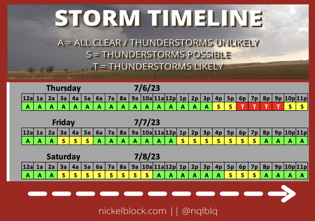
Everyday has the potential for rain it seems for the next few days. As we head into the later half of the week storms will be persistent. For today scattered showers will occur and for some areas they could be severe. More severe thunderstorms will occur this afternoon into tonight. Tomorrow into the weekend we will see more scattered rain showers than thunderstorms which is always better. The coastal areas of Mississippi and Louisiana have the greater chance of seeing rainfall then the more central areas of the state.
[wpcode id=”41149″]
The Cooling Relief
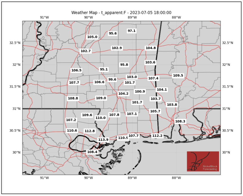
Temperatures will be cooler this today and into this weekend than it has been the past week. Cooling does not mean cold. High temperatures will be in the upper 80s to the low to mid 90s. However, the feels like temperatures are still in the low 100s due to the high humidity. Scattered showers will bring some cooling but not for long enough. Today highs will be in the mid to high 80s and low 90s for some areas but due to the humidity the feels like temperatures are in the upper 90s and low 100s. Just be mindful of the humid air because it always makes it feel warmer than it is.
[wpcode id=”41149″]
Pattern Changes Causing Shifts: Extended Outlook
We are seeing a great change in our weather pattern. As we shift into the weekend and early next week we notice cooler temperatures and a stormy weather pattern. A trough is making its way across the midwest and will dip down into our area next week. This will continue to bring the cooler temperatures compared to previously. There is also a low pressure system across the midwest that is bringing a lot of this stormy weather. This wet pattern we are in brings some cyclonic action which leads to some possible intense storms. Currently the severe weather threat is low but it is something to look out for later into next week.
[wpcode id=”41149″]
Regional Day-To-Day Forecast
Today: Showers and thunderstorms. High temperatures in the upper 80s to low 90s. Winds southwest around 5 mph. Chance of rain 80%.
Tonight: Mostly cloudy. Chance of showers and thunderstorms. Low temperatures in the low to mid 70s. Winds southwest around 5 mph. Chance of rain 50%.
Friday: Mostly cloudy. Chance of showers and thunderstorms. High temperatures in the upper 80s to low 90s. Winds west 5 to 10 mph. Chance of rain 70%.
Friday Night: Partly cloudy. Low temperatures in the low to mid 70s. Winds west around 5 mph. Chance of rain 30%.
Saturday: Mostly sunny. Chance of showers and thunderstorms. High temperatures in the low to mid 90s. Winds west 5 to 10 mph. Chance of rain 50%.
Saturday Night: Partly cloudy. Low temperatures in the low to mid 70s. Winds southwest around 5 mph. Chance of rain 20%.
Sunday: Mostly sunny. Chance of showers and thunderstorms in the afternoon. High temperatures in the low to mid 90s. Winds south, southwest around 10 mph with gusts up to 20 mph. Chance of rain 60%.
Sunday Night: Mostly cloudy. Low temperatures in the low to mid 70s. Winds south, southwest 5 to 10 mph with gusts up to 20 mph. Chance of rain 50%.
Monday: Partly sunny. Chance of showers and thunderstorms in the afternoon. High temperatures in the upper 80s to low 90s. Winds west 5 to 10 mph. Chance of rain 70%.
Monday Night: Partly cloudy. Chance of showers and thunderstorms. Low temperatures in the low to mid 70s. Winds southwest 5 to 10 mph. Chance of rain 50%.
Tuesday: Mostly sunny. Chance of showers and thunderstorms. High temperatures in the upper 80s to low 90s. Winds west 5 to 10 mph. Chance of rain 60%.
Tuesday Night: Mostly cloudy. Low temperatures in the low to mid 70s. Winds southwest 5 to 10 mph. Chance of rain 20%.
Wednesday: Partly sunny. High chance of showers and thunderstorms. High temperatures in the low to mid 90s. Winds southwest 5 to 10 mph. Chance of rain 40%.


