
Friday Afternoon Severe Storms
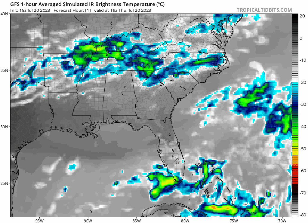
Severe weather will be in the regional area with thunderstorms being our primary concern along with the elevated heat risk today. The biggest area of concern will be largely concentrated to the northern halves of Mississippi and Alabama for this afternoon. An MCS will be moving through the area that will be the main instigator for these storms.
However, the strong mid and upper level flow throughout the Central Plains extending into the Eastern Central region create the possibility for hail and and isolated severe showers. The right entrance region of the jet stream will create upper-level divergence in the atmosphere that will aid in this severe weather

In Mississippi, generally anywhere north-northeast of Jackson will likely experience strong gusty winds and possible hail in combination with these thunderstorms while further south will be more tame today. Traveling east on I-20 may see increasing storms especially heading into Alabama. Be careful out on the road when driving through the Slight Risk area and pull over in case of sudden severe weather like hail and isolated thunderstorms. This storms will occur around the afternoon at its peak.
[wpcode id=”41149″]
Weekend Storms with Slight Heat Relief!
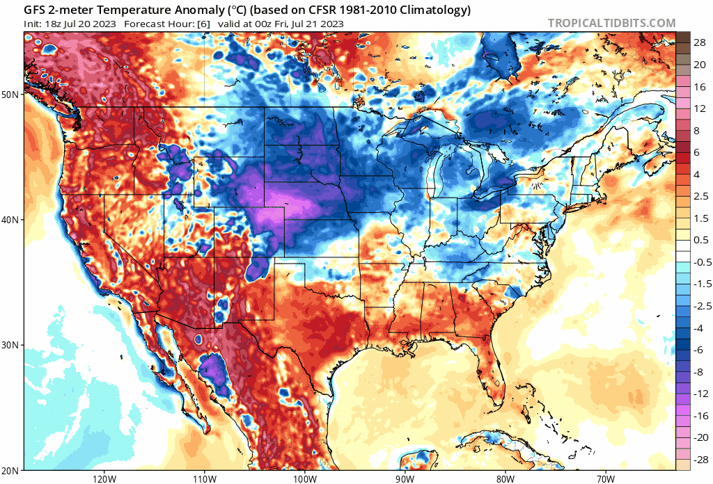
On Saturday, the forecast area seeing the most of the chances for thunderstorm activity will be along the southern coast. The severity of the storms will lessen a bit by the time it reaches the shore as the upper air calms down. As this cold front continues to moves out, there will a slight relief in temperature. Although the map below looks like a strong wave of cold temperatures are inbound, high temperatures out in open sun will still reach expected temperatures well into the 90s throughout the weekend into the start of next week. The anomaly map better shows the movement of the cold front rather than expected temperatures.
After the cold front sweeps through today, most of the convection and storms will be concentrated along the coast for Saturday into Sunday. There will be a marginal risk for thunderstorms but overall will not pose as much of a threat compared to the storms today.
[wpcode id=”41149″]
Extended Outlook

Looking further ahead into the end of next weekend, there is some decent model agreement of the eastern trough weakening over the weekend as our ridge out west shifts east. Sadly, this means any chance of lessening heat over the next week is out the window as severe heat will continue to remain an issue across the South Central US. Temperatures will climb back into the mid to upper 90s by the end of next week.
[wpcode id=”41149″]
Regional Day-To-Day Forecast
Today: Sunny. Chance of showers and thunderstorms. High temperatures in the mid to upper 90s with heat index well into the 110s further south. West winds around 5 mph. Chance of rain 20%.
Tonight: Partly cloudy. Chance of showers and thunderstorms after 2 AM. Low temperatures in the upper 70s to low 80s. West winds around 5 mph. Chance of rain low around 20%.
Saturday: Partly sunny. Chance of showers and thunderstorms in the afternoon after 2pm. High temperatures in the mid to upper 90s with heat index over 100 into the 110s further south. West winds around 5 mph. Chance of rain 60%.
Saturday Night: Partly cloudy. Chance of showers and thunderstorms. Low temperatures in the low to mid 70s. East Northeast winds around 5 mph. Chance of rain 60%.
Sunday: Mostly sunny. Chance of showers and thunderstorms in the afternoon. High temperatures in the low to mid 90s. Northeast winds around 5 mph. Chance of rain 50%.
Sunday Night: Partly cloudy. Chance of showers and thunderstorms. Low temperatures in the low to mid 70s. South winds around 5 to 10 mph. Chance of rain 50%.
Monday: Sunny. Chance of showers and thunderstorms. High temperatures in the low to mid 90s. Northwest winds around 5 to 10 mph. Chance of rain 40%.
Monday Night: Partly cloudy. Chance of showers and thunderstorms. Low temperatures in the low to mid 70s. South winds around 5 to 10 mph. Chance of rain 40%.
Tuesday: Sunny. Chance of showers and thunderstorms. High temperatures in the low to mid 90s. Southwest winds around 5 to 10 mph. Chance of rain 40%.
Tuesday Night: Partly cloudy. Low temperatures in the upper 70s to low 80s. Southwest winds around 5 to 10 mph.
Wednesday: Sunny. Possible afternoon thunderstorms. High temperatures in the mid to upper 90s. Southwest winds around 5 to 10 mph.
Wednesday Night: Mostly clear. Low temperatures in the mid to upper 70s. South wind around 5 to 10 mph.


