I hope everyone is enjoying the relief from the extreme heat from the past two weeks. This week we will experience milder temperatures comparatively, but plenty of rain will be accompanying them. The return of moisture from the Gulf of Mexico is also going to be sticking around for the rest of the week.
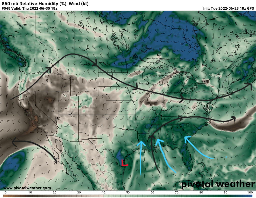
The average pattern for the rest of the week will be southerly flow from the Gulf of Mexico bringing a higher moister content to the Gulf States as depicted above. The low pressure system (invest 95L) off of the Louisiana Coast on Wednesday will aid in increased deep layer moisture and the southerly flow. This will keep the region sufficiently moist to support afternoon showers and thunderstorms that arise from the daytime heating.
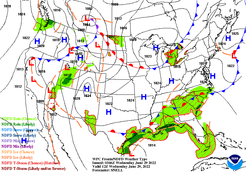
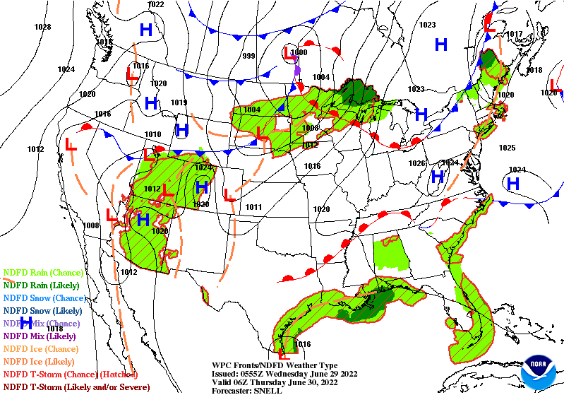
The stalled frontal boundary over the Southeastern states provides some lift for numerous storms to pop off into Wednesday. This boundary keeps any drier air well to the north as it becomes a warm front on Thursday and lifts back to the north itself.
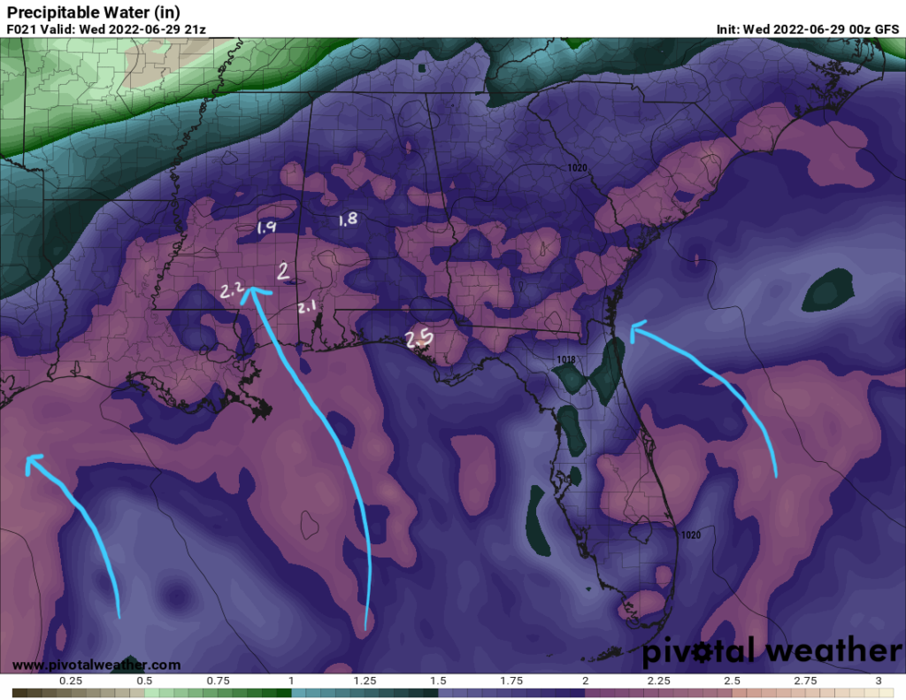
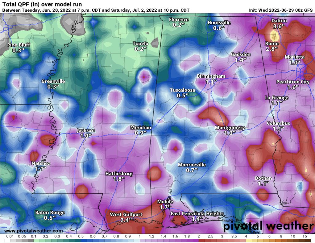
Thunderstorms driven by diurnal heating will have plenty of moisture to work with as we see precipitable water values above 2″ for most of southeast Mississippi and southwest Alabama. This implies that the column of the atmosphere at these points could support locally heavy rainfall and localized flooding with the slower moving storms.
The story for Wednesday will be one retold for the rest of the week as this pattern persists to bring numerous showers and storms into the area. Into the weekend, locally heavy rainfall is expected as there is a high chance for showers and storms everyday. Some places may see over 1.5″ of rainfall during the next four-day period.
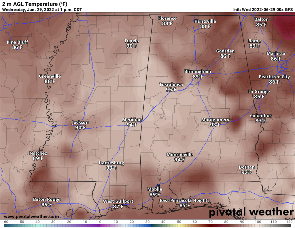
Temperatures will be mild in the short term with highs in the upper 80s and low 90s. High percentage of cloud cover and plenty of rainfall will help to suppress these temperatures. The heat index will struggle to reach 100F during this period. Temperatures will ramp back up again by Sunday with highs in the upper 90s and past 100F by Monday. In turn, the heat index will increase too ranging between 100F and 105F. Dangerous heat conditions could return too by next week.
Day-to-Day Forecast
Wednesday
Mostly cloudy with a 70-percent chance of storms in the early afternoon to evening hours. High temperatures in the low 90s with heat indices in the upper 90s. Low temperatures in the low 70s.
Thursday
Mostly cloudy with a 70-percent of scatter storms in the afternoon/evening hours. Highs in the upper 80s and lows in the lower 70s.
Friday
Mostly cloudy with a 60-percent chance of thunderstorms. Highs in the upper 80s and lows in the upper 60s and low 70s.
Saturday
Partly cloudy with a 50-percent chance of thunderstorms. Highs in the upper 80s with some spots in the lower 90s. Lows in the low 70s.
Sunday
Partly cloudy with a 50-percent chance of precipitation. Highs in the mid 90s and heat indices in the upper 90s. Lows in the low-to-mid 70s.
Monday
Partly cloudy with a 40-percent chance of precipitation. Highs in the mid 90s with heat indices in the low 100s. Lows in the mid 70s.
Tuesday
Partly cloudy with a 40-percent chance of precipitation. Highs in the mid-to-upper 90s with heat indices between 100F and 105F. Lows in the mid 70s.


