In case you couldn’t tell, it’s hot outside, really hot.
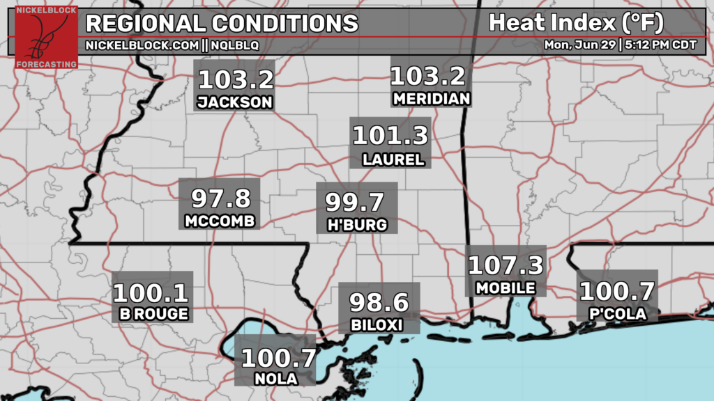
While the northern Plains and upper Midwest are getting pounded by severe weather, we’re stuck under the heat dome. This means highs in the 90s (with heat indexes well over 100) and a low chance of storms during the afternoons.
This pattern is not anything historic but it’s definitely unpleasant. It does appear that the ridge may shift a little bit towards the weekend and beyond which may open the door for some precipitation chances that can calm the heat a bit.
Parts of our area are under a heat advisory through tomorrow evening so make sure to drink plenty of water and take breaks in the AC if you must be outside.

Tonight
Steamy and calm. While there won’t be any rain, there may be some fog.
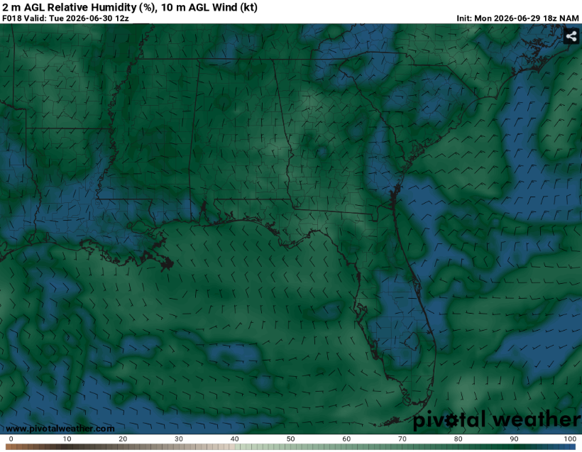
While the NAM can sometimes be overly moist, the overall pattern (under the ridge, weak winds, high RH) will be conducive for fog development. Make sure to drive slow when encountering fog.
Lows will be in the mid 70s. Given the nearly saturated air, this will provide little relief from the heat. Make sure to check on outdoor animals and those who don’t have reliable AC.
Tomorrow
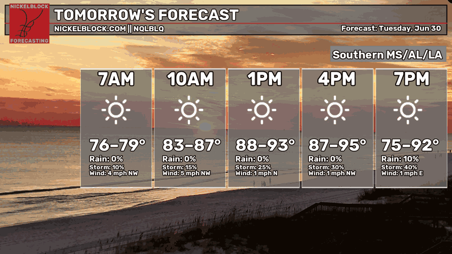
Heat. Lots of it. Tomorrow will be a great day to go to the pool and not to do yard work. Prolonged exposure to this could be dangerous, so try to limit time outside as much as possible.
The ridge will be parked just to our north allowing for large scale subsidence. Therefore, it should be a mostly sunny day but as usual, we cannot entirely rule an isolated storm or two. Chances for storms will ramp up during the early evening hours as shear and instability are maximized.
The Storm Prediction Center has outlined our area in a level one out of five marginal risk for damaging winds. Most places will stay dry but those that don’t may experience very heavy rain and frequent lightning along with the wind threat. Heat index values may exceed 105 in areas that stay sunny.
Fog may also be a concern if skies remain clear through the overnight hours.

The Day After Tomorrow
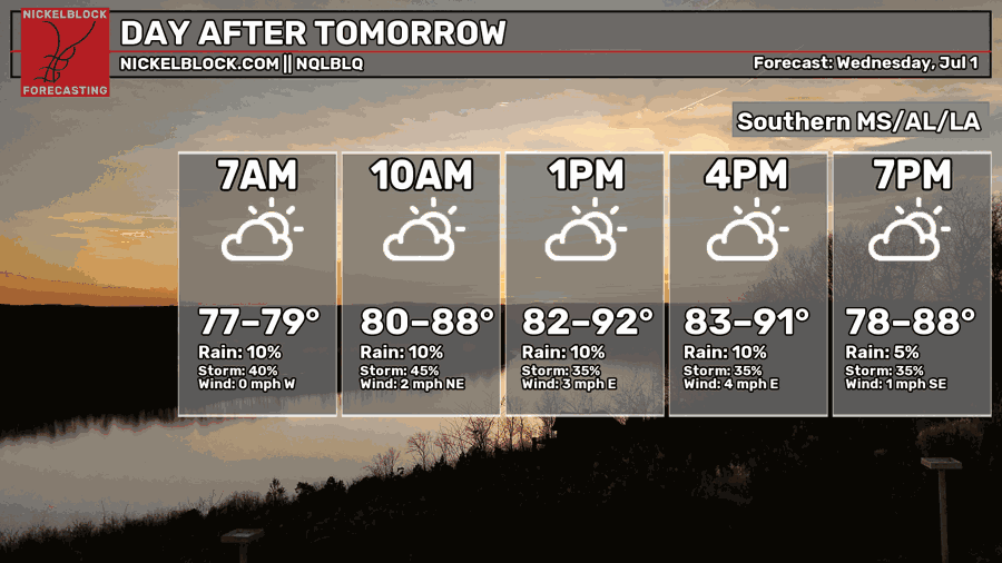
Another day, more heat. The difference is that there is slightly higher chance of storms (and therefore clouds).
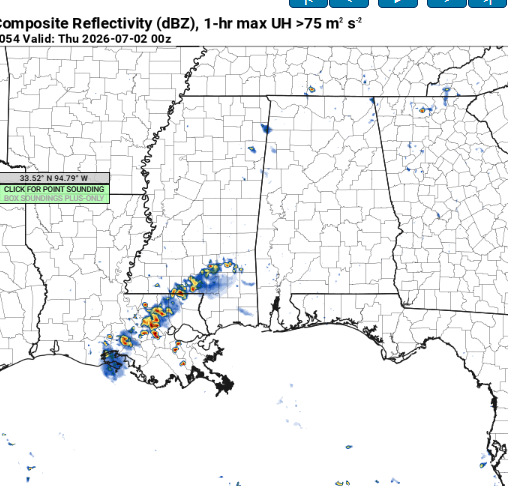
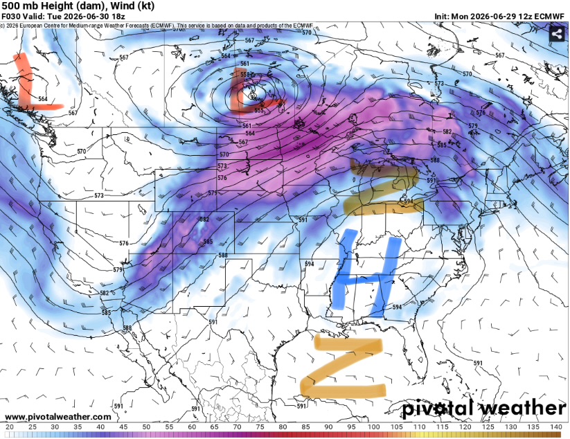
Some models are showing a small cluster of thunderstorms during the late afternoon and early evening (3km NAM shown above). If these storms grow upscale, they may be able to produce some damaging winds. Vertical wind shear will be weaker than Tuesday though, so long lived or organized convection is unlikely.
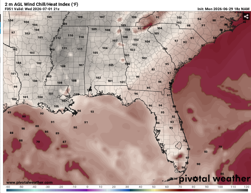
The main threat will again be the heat. Heat index values may exceed 110 as surface dew points continue to rise. This prolonged heat will be especially hazardous to those who have limited access to AC along with the elderly and young children. This is not the day to cut the grass.
Fog may again occur if skies are clear overnight. Lows will be in the mid 70s.

Extended Outlook
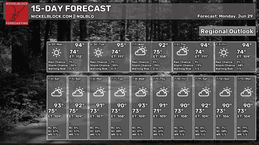
What a surprise, it might be a little toasty. The summer ridge is now fully here. This may shift west a bit causing our area to end up in slightly wetter pattern.
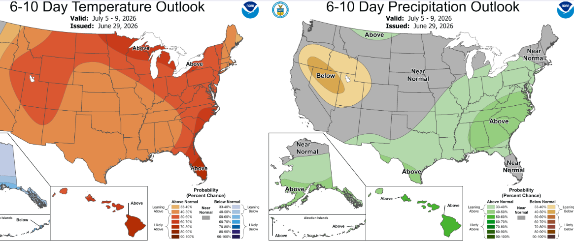
The Climate Prediction Center has outlined our region as having an increased chance at wetter and warmer than normal conditions. This will likely mean warm overnight lows and scattered afternoon thunderstorms.
Not every day will unbearably hot but most of the time you won’t want to be outside during peak heating.
Day-By-Day Forecast
Tonight- Calm and clear with a low in the mid 70s. No rain, but some fog possible
Tomorrow- Sunny and humid with a high in the upper 90s. Thunderstorm chances increase towards late afternoon.
Tomorrow Night- Some thunderstorms possible in the early evening. Partly cloudy with a low in the mid 70s.
Wednesday- Mostly sunny with a high in the mid 90s. Afternoon thunderstorms possible.
Wednesday Night- Calm and clear with a low in the mid 70s. It won’t rain but there may be fog.
Thursday- Mostly sunny with a high in the mid 90s. Isolated afternoon thunderstorms possible.
Thursday Night- Mostly clear with a low in the mid 70s. No precipitation is expected.
Friday- Similar to Thursday. Chance of afternoon thunderstorms, otherwise mostly sunny with a high in the mid 90s.
Friday Night- Mostly clear and dry. Low in the mid 70s.
Saturday- Afternoon thunderstorms possible. Mostly sunny with a high in the mid 90s.
Saturday Night- Mostly clear with a low in the mid 70s. Dry.
Sunday- Scattered afternoon thunderstorms likely. Mostly sunny with a high in the mid 90s.
Sunday Night- Isolated thunderstorms possible. Lows in the mid 70s and partly cloudy.


