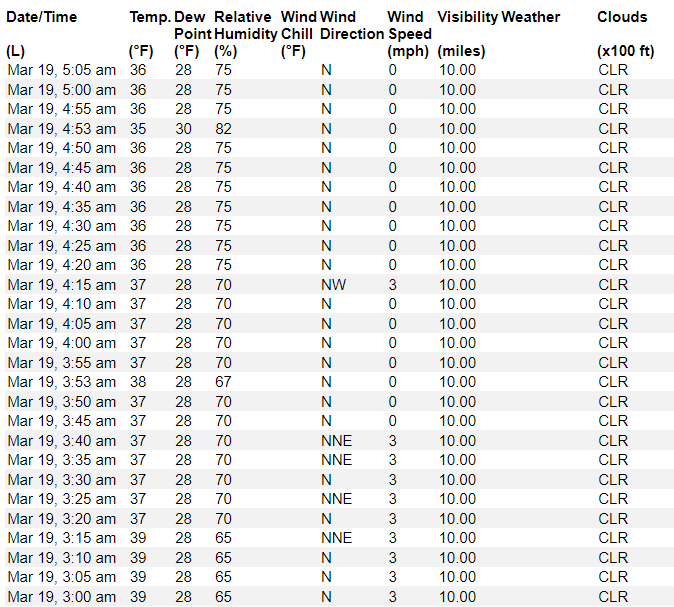
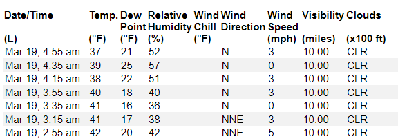
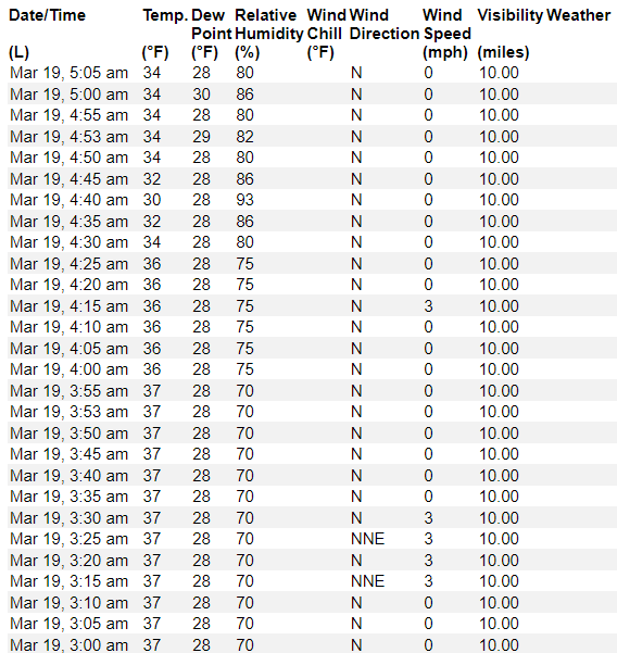
It is probably a bit frosty at your house this morning. Officially, temperatures have dropped to around 36F at many weather stations across the area. And usually frost starts when the temperatures drops below 36F and when the wind goes calm.
It looks like we’ve got another few hours of cold (at the time of this writing) before things rebound pretty quickly today.
Model guidnace suggests highs will climb back to around 60F to 65F today for most folks.
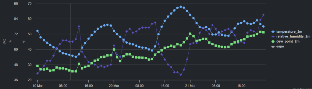
The trend during the next 72 hours is for temperatures to slowly climb back to 70s for highs with dewpoint values in the 60s. Then we should get in on another shot for storms by later this week – current model trends suggest Friday will be the wettest day with scattered storms possible.
Right now, severe weather looks less likely with the next system. Iit is worth monitoring, sure, given that it is March… But I’m not overly concerned at the moment. The Storm Prediction Center shares this sentiment and does not have the area highlighted with any increased risk for severe weather. .
REGIONAL DAY TO DAY FORECAST
Today: Sunny. Highs in the lower 60s. Northeast winds around 5 mph, becoming northwest this afternoon.
Tonight: Mostly clear. Lows in the mid 30s. Southwest winds around 5 mph.
Wednesday: Mostly sunny. Highs in the lower 70s. West winds around 5 mph, becoming southwest in the afternoon.
Wednesday Night: Partly cloudy in the evening, then becoming mostly cloudy. Not as cool with lows in the mid 40s. South winds around 5 mph in the evening, becoming light and variable.
Thursday: Mostly cloudy. A slight chance of showers in the afternoon. Highs in the upper 60s. East winds 5 to 10 mph. Chance of rain 10 percent.
Thursday Night: Mostly cloudy with a 20 percent chance of showers. Lows in the lower 50s.
Friday: Mostly cloudy with a chance of showers in the morning, then partly sunny with a slight chance of showers in the afternoon. Highs around 70. Chance of rain 40 percent.
Friday Night: Mostly clear. Lows in the lower 50s.
Saturday: Sunny. Highs in the lower 70s.
Saturday Night: Mostly clear. Lows in the mid 40s.
Sunday: Sunny. Highs in the mid 70s.
Sunday Night: Partly cloudy in the evening, then becoming mostly cloudy. Lows in the mid 50s.
Monday: Mostly cloudy. A slight chance of showers and thunderstorms in the afternoon. Highs in the mid 70s. Chance of rain 20 percent.


