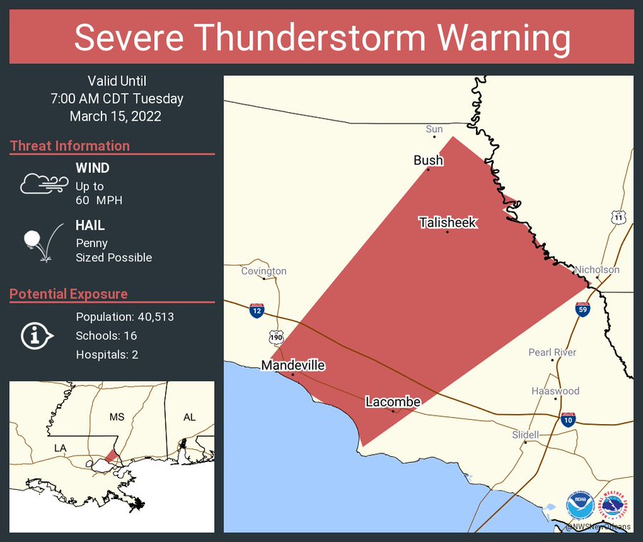
Things will start off rather stormy this morning. Already one Severe Thunderstorm Warning across parts of Louisiana. This is only in effect until 7a, so by the time you read this (for most of you) this will be long expired. But it is a good example of what I was discussing yesterday that the atmosphere has juuuust enough ‘umph’ closer to the coast to squeeze out a severe storm.
For everyone else, it is a lot of rain and thunder.

The rain will continue for the next few hours, but once the leading edge pushes east, ti will be mostly light to moderate soaking rain. By this afternoon – around 2p – the rain should come to an end for a majority of the area.
The dry slow (brown arrows) will cut off any available moisture in the low-levels and put an end to any shower activity, and may even allow the sun to poke back through. Then things will cloud back up later in the evening and overnight as another round of a few showers moves through as the cold front slides by.

Then our attention turns to Friday and also next Tuesday. The SPC is already highlighting parts of the area with a Slight Risk for each day. That is a “2” on the 1-to-5 scale where “5” is the highest risk for the most significant severe weather.


It isn’t anything to get too concerned about yet, but something worth monitoring in the coming days and through the weekend for certain.
Day to Day Forecast
Today
Showers and storms possible through midday, then clearing is possible. Breezy. Highs in the lower 70s. Chance of rain near 100-percent.
Tonight
Mostly cloudy with a few showers possible before midnight. Lows in the lower 50s. Chance of rain 30-percent.
Wednesday
Skies clearing through the day, becoming mostly sunny by afternoon. Highs around 70.
Wednesday Night
Partly cloudy. Lows in the upper 40s.
Thursday
Mostly sunny. Highs in the mid 70s.
Thursday Night
Increasing clouds overnight with a few showers possible. Lows in the mid 50s. Chance of rain 30-percent.
Friday
Mostly cloudy with showers and storms possible. Some severe. Highs in the mid 70s. Chance of rain 70-percent.
Friday Night
Mostly clear. Lows in the upper 40s.
Saturday
Mostly sunny. Highs in the upper 60s.
Saturday Night
Mostly clear. Lows in the lower 40s.
Sunday
Sunny. Highs in the mid 70s.
Sunday Night
Mostly clear. Lows in the upper 40s.
Monday
Mostly sunny. Highs in the upper 70s.


