Another day of gusty winds has passed bringing a few showers into parts of south and central Mississippi today. This looks to be the norm for the next several days as we start to slow down the cold fronts and we approach our more late-Spring pattern. Let’s take a look at what’s coming up this week.
Starting off on Monday, the main cold front we’ve been anticipating will arrive in the afternoon for southeastern Mississippi. Areas of south Louisiana will likely see more of the severe weather with a line that gains some more traction as it moves further towards the coastline. Near our neck of the woods, the line will be a bit thinner, but with some heavy rain possible and even a small chance of hail. Rainfall totals near the Pinebelt will range from half an inch to an inch.
Over the week, the high pressure system in the Atlantic will still remain along with a steady Gulf stream near the surface. With temperatures rising and more low level clouds developing, we’ll have a slight chance of the pop-up (diurnal) showers mixed with another low pressure system developing in the Rockies. Due to the high pressure blockage in the Atlantic, this will keep the low pressure system from digging south and moving towards the Great Lakes. Since there will be a mix of a more climatic system with a dynamic system, it means we’re going to have a mix of showers and thunderstorms for the next several days.

Come Wednesday, we’ll see our first taste of some Gulf stream/sea breeze storms moving in from the south. While we may not see as potent of storms as our neighboring states to the west, we’ll see a shower and possible thunderstorm developing in the mid-afternoon across the state. Thursday will also see a small chance of pop-up rain showers before the low pressure system gets its act together.
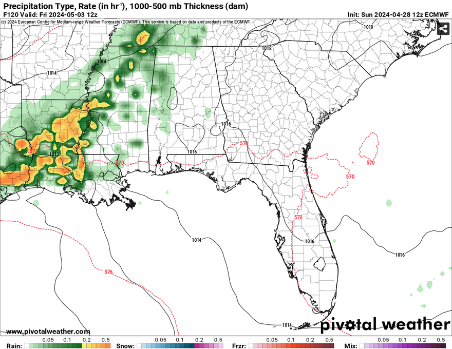
Friday is where the more organized line of storms will arrive. Most of the heaviest rain looks to stay to the west in Louisiana, but we’ll still see a fair bit of rain before the line weakens over us. After this, we’ll be in a brief state of warm and partly cloudy weather and the stray shower or two over the weekend.
[wpcode id=”41179″]
Regional Day-to-Day Forecast
Tonight – Mostly cloudy, with a low in the mid 60s. Southeast wind 10 to 15 mph, with gusts as high as 20 mph.
Monday – A chance of showers and thunderstorms in the afternoon. Some of the storms could produce heavy rain. Cloudy, with a high near 80. South wind 10 to 15 mph, with gusts as high as 25 mph. Chance of precipitation is 70%. New rainfall amounts between a half and three quarters of an inch possible.
Monday Nigh – Showers likely and possibly a thunderstorm overnight. Some of the storms could produce heavy rain. Mostly cloudy, with a low in the mid 60s. South southeast wind 5 to 10 mph becoming light south in the evening. Chance of precipitation is 60%. New rainfall amounts between a tenth and quarter of an inch, except higher amounts possible in thunderstorms.
Tuesday – A slight chance of showers and thunderstorms in the morning. Partly sunny, with a high in the mid 80s. Calm wind becoming south southwest around 5 mph in the afternoon. Chance of precipitation is 40%.
Tuesday Night – Patchy fog after midnight. Otherwise, partly cloudy, with a low around 64. Calm wind.
Wednesday – A 40 percent chance of showers and thunderstorms, mainly in the afternoon. Patchy fog before 9am. Otherwise, partly sunny, with a high in the mid 80s. Calm wind becoming south southeast around 5 mph in the afternoon.
Wednesday Night – A 10 percent chance of showers and thunderstorms before sunset. Mostly cloudy, with a low in the mid 60s. Calm wind.
Thursday – Mostly sunny, with a high in the upper 80s. Calm wind becoming south southeast around 5 mph in the afternoon.
Thursday Night – Mostly cloudy, with a low in the mid 60s. South wind around 5 mph becoming calm in the evening.
Friday – A 20 percent chance of showers and thunderstorms. Partly sunny, with a high in the mid 80s.
Friday Night – A 20 percent chance of showers and thunderstorms. Mostly cloudy, with a low in the mid 60s.
Saturday – A 20 percent chance of showers and thunderstorms. Partly sunny, with a high in the mid 80s.
Saturday Night – Mostly cloudy, with a low in the low 60s.
Sunday – A 20 percent chance of showers and thunderstorms. Partly sunny, with a high in the mid 80s.
[wpcode id=”41149″]


