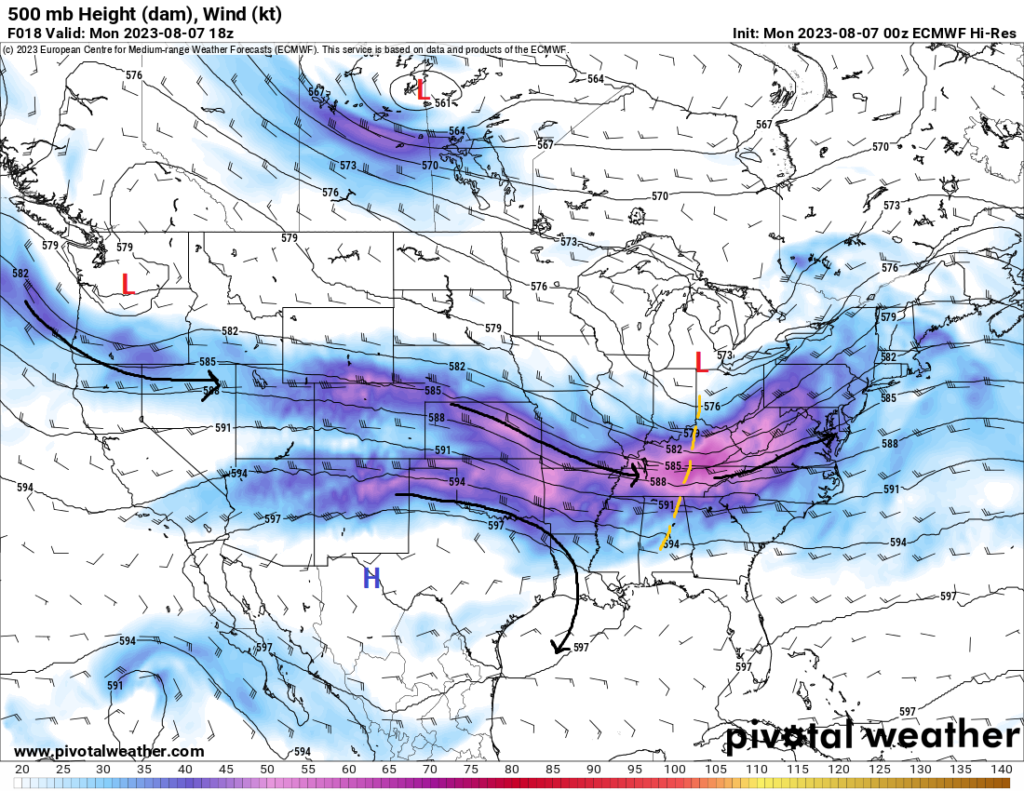
Tell me if you’ve heard this before, very hot summertime heat and isolated chances for thunderstorms over the next week. That phrase will be the continuing theme throughout the southern MS/AL/LA region through the next 7 days. High pressure across the southern US will hang around and gradually build over the area, helping to keep us all very hot and humid.
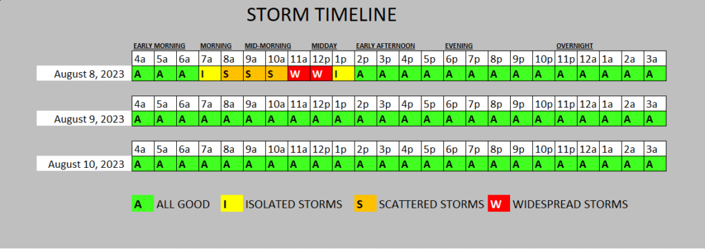
Outside of the heat, isolated to scattered thunderstorms will be possible almost every day this week. Most of these will remain below severe limits, however especially today, some thunderstorms this morning and afternoon as they move northern parts of the forecast area. The Storm Prediction Center has even outlined parts of the area with a Slight Risk for severe weather.
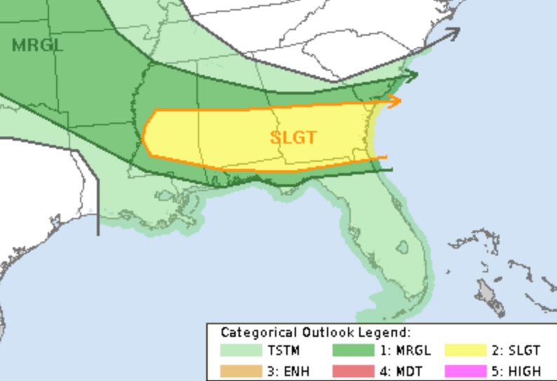
The main concern with storms today will be brief heavy rain, lightning, and wind gusts exceeding 60mph. We may also see some small hail. The tornado threat is close to zero, but can’t be completely ruled out. If a tornado does form, it would be brief and likely quite weak.
But don’t get too excited, there isn’t a big change on the way. It’ll be largely the same forecast day after day this time, so let’s take a closer look at what is going on over the coming days.
Short-Term Outlook
A complex of showers and thunderstorms moving in from the northwest will sweep through northern portions of the forecast area this morning and afternoon. Places like Jackson, MS and anyone between I-20 and US-84 will have the best chance to see these thunderstorms, some of which may be marginally severe. Main threats with these storms will be largely damaging winds, although isolated hail events may be possible. Areas further south, like Hattiesburg, MS for example, will have a much more isolated chance at seeing these storms through the afternoon, although the main hazards will be the same as further up north.
Shifting towards the heat for today through Thursday, widespread high temperatures in the upper 90s to low 100s can be anticipated each afternoon. Dew point temperatures in the low to mid 70s will keep the thick air feeling hanging around and help to drive heat index temperatures well above 105°F to possibly 110°F or even higher. Heat advisories and warnings will more than likely be needed over the next few days in response to this heat and safety precautions to protect yourself from the heat is strongly advised. Take frequent breaks if you have to be outside and keep yourself well hydrated throughout the day.
Extended Outlook
The long-term period will largely be the same over the next week. As this high-pressure builds, this will keep temperatures consistently in the upper 90s to low 100s over the next 7 days. This also will limit the potential for more organized thunderstorm activity, with the majority of rainfall events coming in the form of pulse showers and storms in the afternoon and evening hours in tandem with the diurnal heating process. This may come as a relief for some that see the rain, or if the rain comes early enough, will just add to the overall humidity in the air and not change (or even increase) the apparent heat outside.
Not a whole lot of change from this regime is expected anytime soon so don’t be surprised if we stick with this theme over the next two weeks in general. As mentioned previously, protect yourselves from the heat and stay hydrated.
REGIONAL-DAY-TO-DAY FORECAST
Tuesday: Mostly sunny and hot, with a chance of showers and thunderstorms. High temperatures in the mid to upper 90s. Heat indices may reach up to 110°F. Chance of rain 30%.
Tuesday night: Partly cloudy. Low temperatures in the upper 70s to low 80s.
Wednesday: Mostly sunny and hot. High temperatures in the mid to upper 90s. Heat indices may reach up to 105°F.
Wednesday night: Partly cloudy. Low temperatures in the upper 70s to low 80s.
Thursday: Partly cloudy and hot. High temperatures in the upper 90s to low 100s. Heat indices may reach up to 110°F.
Thursday night: Partly cloudy. A stray shower or thunderstorm is possible. Low temperatures in the upper 70s to low 80s. Chance of rain 20%.
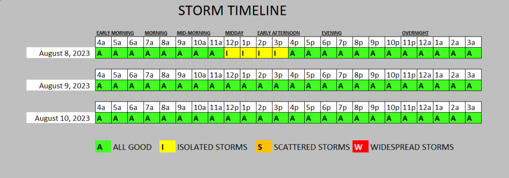
Friday: Partly cloudy and hot, with a chance of showers and thunderstorms. High temperatures in the upper 90s to low 100s. Heat indices may reach up to 110°F. Chance of rain 30%.
Friday night: Mostly cloudy, with a chance of showers and thunderstorms. Low temperatures in the upper 70s to low 80s. Chance of rain 30%.
Saturday: Mostly cloudy and hot, with a chance of showers and thunderstorms. High temperatures in the upper 90s to low 100s. Heat indices may reach up to 110°F. Chance of rain 30%.
Saturday night: Mostly clear. Low temperatures in the upper 70s to low 80s.
Sunday: Mostly cloudy and hot, with a chance of showers and thunderstorms. High temperatures in the upper 90s to low 100s. Heat indices may reach up to 110°F. Chance of rain 30%.
Sunday night: Overcast skies. Low temperatures in the upper 70s to low 80s.
Monday: Mostly cloudy and hot. A stray shower or thunderstorm is possible. High temperatures in the upper 90s to low 100s. Heat indices may reach up to 110°F. Chance of rain 20%.
Monday night: Partly cloudy. Low temperatures in the upper 70s to low 80s.


