You know, there’s nothing quite like temperatures in the 90s in the middle of May. That said, while those 90-degree temperatures may be sizzling, we’re gonna have a little reprieve with those upper 60s dewpoints instead of the sticky 70s. Overnight, on most nights this week, we’re not gonna cool off too much either. We’re looking at lows in the upper 60s and low 70s.
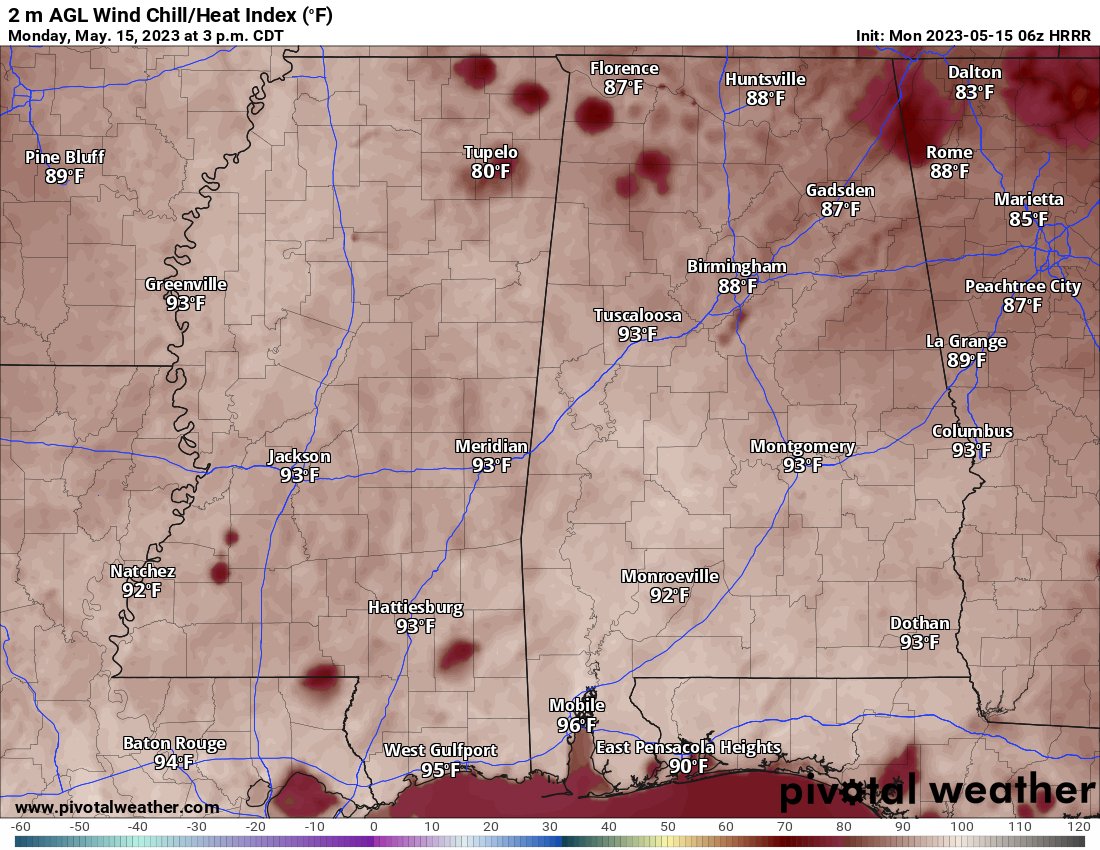
But suffice to say it will be warm and muggy.
Surface high pressure is still gonna be doing its thing, so we won’t be seeing much rain or storms today compared to what we’ve had in the past few days. But hey, as we move into summer, we can still expect some of those afternoon showers and thunderstorms to pop up, thanks to the diurnally driven activity.
According to our showerter-range hi-res guidance, any chance of precipitation is gonna hold off until the early evening, and it’ll mainly be south of I-20 and near I-59 and to the east. Once the sun starts to go down, though, those rain and storm chances will start to fizzle out. Now, there might be some patchy fog hanging around the Pine Belt area this morning, but nothing too thick and dense to worry about.
Then, as we move through the rest of the week, the pattern starts to change a bit. Tomorrow, as the ridging starts to break down a bit, we may actually see some storms on Tuesday with the possibility of turning marginally severe – especially south of I-20. We’re talking about vertical totals around 27 and SBCAPE around 3000 j/kg. High PWAT values also means a chance we’ll see some locally heavy downpours too.
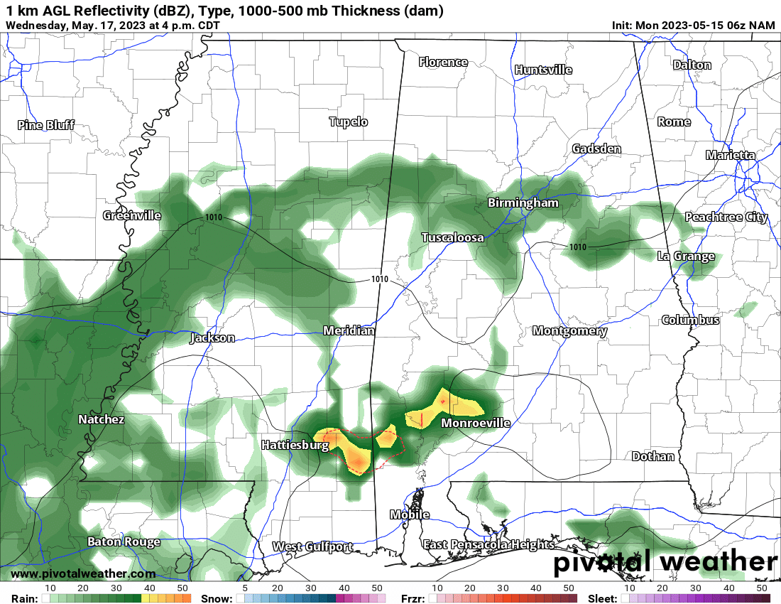
As we move into Wednesday, a cold front is gonna saunter its way southward. It won’t fully clear the area until Wednesday night – and you guessed it, that means more thunderstorms are in the mix. Severe weather here isn’t as likely, though.
Come Thursday, things should start to dry out a bit thanks to some drier air moving in behind the front, but hold on to your umbrellas because that moisture is gonna rebound on Friday and Saturday.
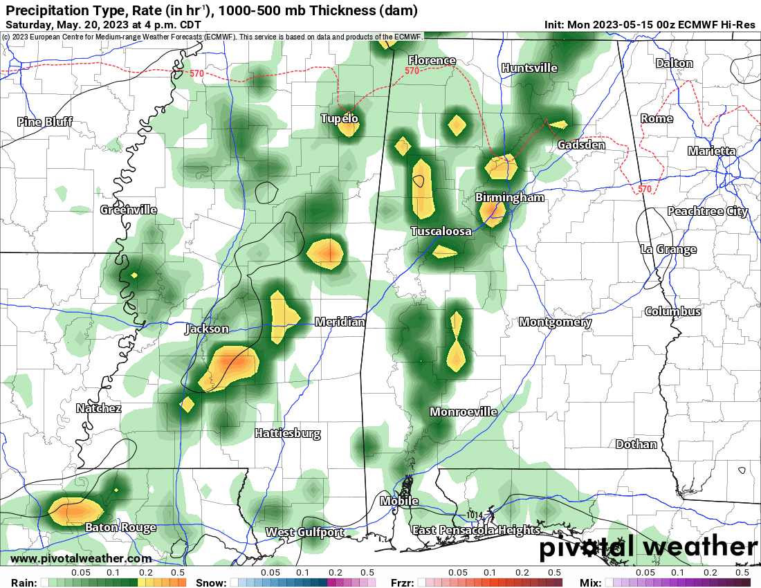
A surface high pressure system over the Gulf is gonna kick in some return flow, and by Saturday afternoon, we’re expecting another cold front to swing through. That means rain and storms are back on the table, especially with sufficient moisture and heating in play.
[wpcode id=”41149″]
EXTRA WEATHER MAPS
This weekend I’m going to try to set some time aside to work on these some more. But here is a look at today’s extra weather data:
Select Data Set:

Like always, if you’d like something added to these maps, please let me know. I’ll do my best!
[wpcode id=”41149″]
REGIONAL DAY TO DAY FORECAST
Today: Passing clouds with showers and storms possible. Highs in the lower 90s. North winds around 5 mph. Chance of rain 40 percent.
Tonight: Mostly cloudy. Lows in the upper 60s. Northwest winds around 5 mph.
Tuesday: Mostly sunny with more storms possible. Highs around 90. Temperature falling into the mid 80s in the afternoon with the expected rain. West winds 5 to 10 mph. Chance of rain 70 percent.
Tuesday Night: Mostly cloudy. Lows in the upper 60s. West winds 5 to 10 mph.
Wednesday: Partly sunny with hit and miss storms throughout the day. Highs in the mid 80s. Northwest winds 5 to 10 mph. Chance of rain 60 percent.
Wednesday Night: Mostly cloudy. Lows in the mid 60s.
Thursday: Mostly sunny. A chance of showers and thunderstorms in the afternoon. Highs in the mid 80s. Chance of rain 30 percent.
Thursday Night: Mostly clear in the evening, then becoming partly cloudy. Lows in the mid 60s.
Friday: Mostly sunny with a few storms possible. Highs in the upper 80s. Chance of rain 20 percent.
Friday Night: Mostly clear in the evening, then becoming partly cloudy. Lows in the mid 60s.
Saturday: Mostly sunny. A chance of showers and thunderstorms in the afternoon. Highs in the upper 80s. Chance of rain 40 percent.
Saturday Night: Mostly cloudy in the evening, then becoming partly cloudy. A slight chance of showers and thunderstorms. Lows in the mid 60s. Chance of rain 20 percent.
Sunday: Mostly sunny. Highs in the mid 80s.


