The title says everything you need to know.
And it’s only gonna get worse.
While the main story in the country will be the severe weather in the Plains, our area will remain locked underneath a strong ridge. Some severe weather threat will likely bleed into at least part of our region on what will likely end up being our best chance for rain in the foreseeable future.
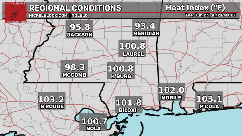
The main story however will be the heat. The next couple days are just a warm up for what is coming down the pipe for the weekend into early next week.

Tonight
Steamy.
Some models are showing a cluster of thunderstorms moving out of Oklahoma and into our area. This may bring some heavy rain and lightning to parts of Louisiana but the exact track (and occurrence) of these storms is very uncertain.
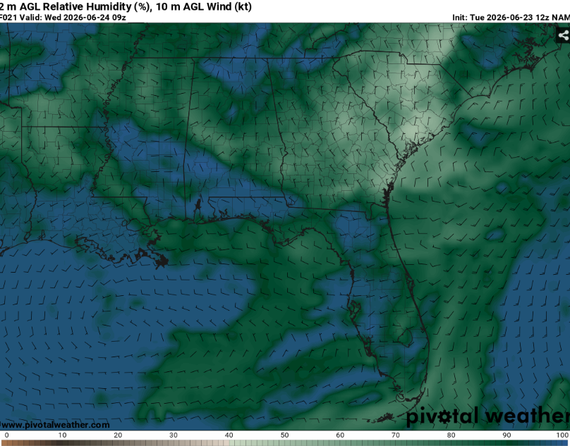
Even without the rain it will feel very humid outside. Given very high relative humidity and weak winds, fog will be possible although not certain. Make sure to slow down and use caution in low visibility.
Temperatures will bottom out in the low to mid 70s.
Tomorrow
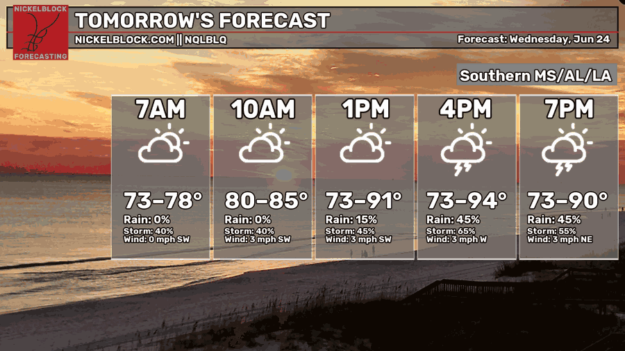
Although it’ll be hot for most of the area, the more impactful piece of tomorrow will be the chance for storms.
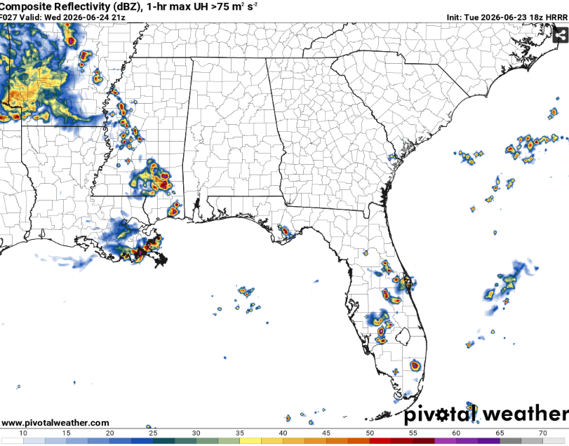
All that hot and humid air will provide plenty of fuel for storms. The big question will be whether or not they actually occur. At least some thunderstorms appear likely in the area but it is unclear how widespread they will be.
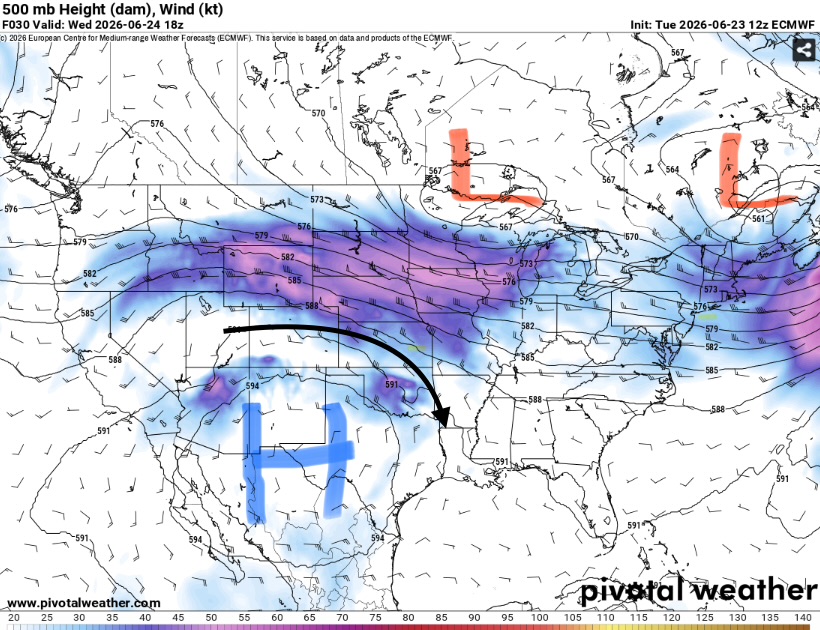
This type of weather pattern is known for ridge rider thunderstorm complexes. The hard part is knowing exactly how long they will last or how far they will go.
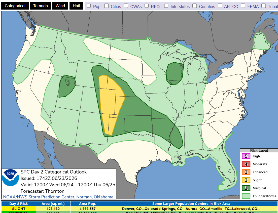
The Storm Prediction Center has issued a level one out of five for parts of Mississippi and Louisiana (mainly for damaging winds). These probabilities may be upgraded if confidence in large bow echo increases.
Highs will be in the low 90s for areas that remain cloud free while storms may keep some areas much cooler.

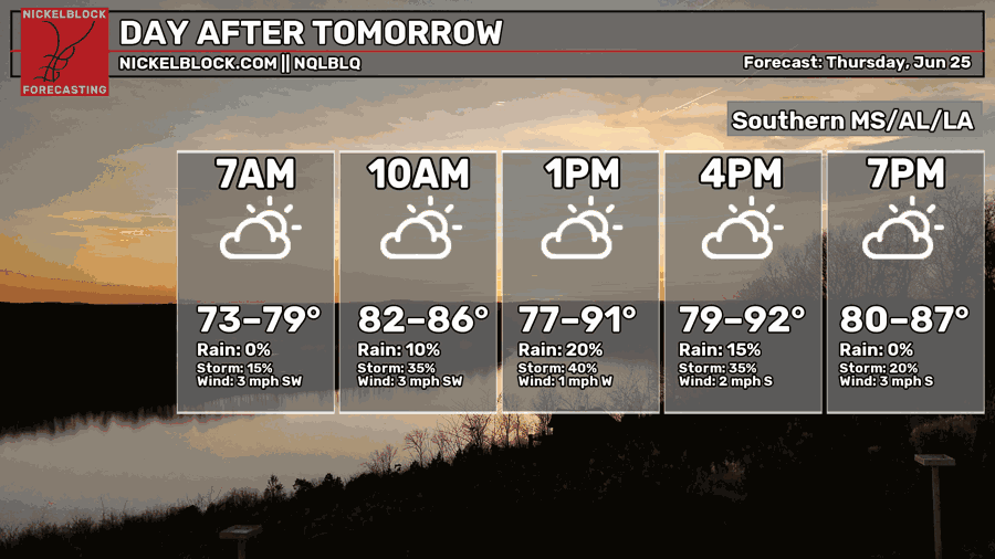
The Day After Tomorrow
A more typical summer day.
Highs will be in the low 90s. Clouds will build throughout the morning and someone will likely get an afternoon thunderstorm. These will not be particularly widespread or severe but may still be capable of heavy rain and frequent lightning.
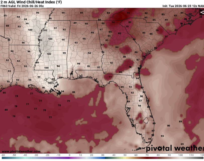
The big story will be the heat. As the ridge moves east, our area will start to feel it. Heat indexes will likely be over 100 in some locations. Make sure to drink plenty of water and take breaks in the ac if you must be outside. A good day to go to the pool.

Extended Outlook.
An outdoor sauna. Yup, the bigtime heat is coming. The ridge appears likely to park itself over the southeast. This means a lot of sun and not a lot of clouds or rain.
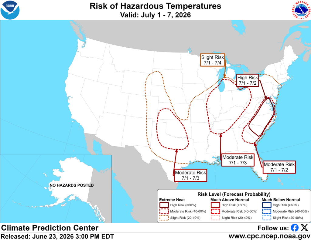
The Climate Prediction Center has outlined the entire southeast in a slight risk for extreme heat. This is not super unusual for this time of year but it does not make it any better. Precipitation chances will be lower and many days may barely see any clouds.
It’s not certain exactly how long the heat will last so make sure to check back here for frequent updates.
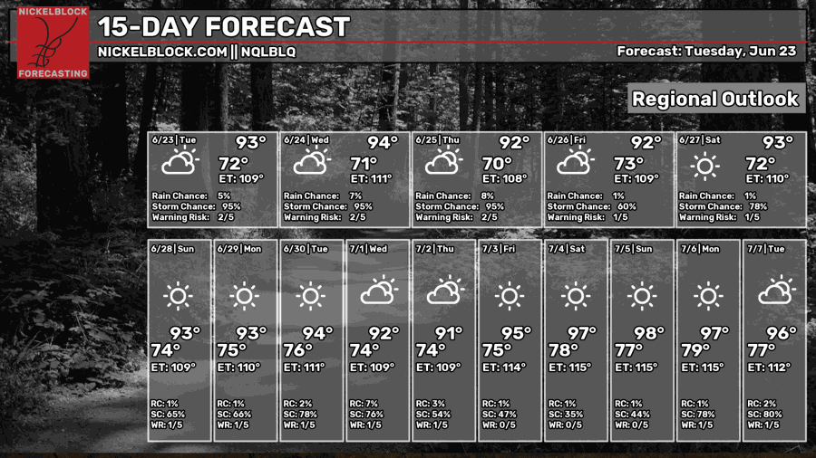
Day-By-Day Forecast
Tonight- Decreasing clouds with a low in the mid 70s. No precipitation is expected but some fog is possible.
Tomorrow- Scattered afternoon thunderstorms likely. Partly sunny with a high in the low 90s
Tomorrow Night- Thunderstorms die off early then mostly cloudy with a low in the low 70s.
Thursday- Chance of isolated afternoon thunderstorms. Mostly sunny with a high in the low 90s.
Thursday Night- Mostly clear with a low in the low 70s. No rain but fog is possible.
Friday- Sunny with a high in the mid 90s. Dry.
Friday Night- Mostly clear with a low in the mid 70s. No rain.
Saturday- Sunny with a high in the mid 90s. Very humid but no precipitation.
Saturday Night- Low in the mid 70s and mostly clear. Dry and calm.
Sunday- Dry and sunny with a high in the mid 90s.
Sunday Night- Low in the mid 70s and mostly clear. No rain.
Monday- Rain chances increase a hair. Mostly sunny with a high in the mid 90s.
Monday Night- Maybe an isolated storm or two. Mostly clear with a low in the mid 70s.


