The East Pacific hurricane season continues to steal the show with seven named storms so far this year; however, don’t sleep on the Atlantic season as the historical peak of activity still has yet to arrive this September.

1) The Saharan Air Layer (SAL) continues to show its presence across the Atlantic Ocean and has kept conditions hostile for tropical development for most of this hurricane season so far.
2) An area of disorganized thunderstorms associated with the Intertropical Convergence Zone (ITCZ) and a tropical wave is progressing westward but will have no room for further development as it becomes sandwiched between dry air to its north and South America.
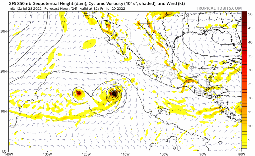
3) Recently designated Tropical Storm Georgette will drift southwestward away from land without much further intensification expected.
4) Tropical Storm Frank is much more organized which will allow it to take advantage of the favorable atmospheric and oceanic conditions and strengthen into a hurricane very soon.

Georgette will drift southwestward where it will experience stronger wind shear hindering it from further strengthening, meanwhile Frank will chug northwestward into a low-shear environment allowing for intensification.

Frank is a sufficiently moist storm allowing for lots of convection and intensification of the storm, meanwhile Georgette is struggling with dry air being wrapped into the southern side of the storm. Convection/thunderstorms are a crucial part of tropical cyclone development and intensification as they can lower surface pressure as air lifts through the thunderstorms and increases wind speeds.
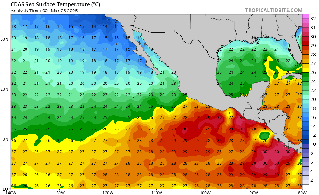
Although Georgette is facing detrimental wind shear and dry air, the storm will be located over significantly warm sea surface temperatures (SSTs) creating instability for convective bursts/thunderstorm development which may allow for the storm to persist longer than previous model guidance has suggested and possibly wrap around Frank’s circulation from a distance (see next GIF).
Georgette will remain a weak storm while Frank takes advantage of the 29C SSTs and continues to organize on its journey northwest. Frank will eventually move over cooler waters as it climbs latitude to 20N. By that point the storm is expected to weaken as the SSTs are not sufficiently warm enough to create instability and fuel the storm.

The National Hurricane Center expects Frank to strengthen to hurricane status sometime today and thankfully not come close to landfall during its peak intensity. The only impacts expected to land will be strong rip currents and rough surf along the southwest coast of Mexico in the coming days as storm-generated swells reach the shoreline.


