Looking ahead to the week, a fairly stagnant upper level pattern will be present for the first half of the week. Persistent ridging will occur over the Southwest, while a couple of troughs are expected to pass through the eastern third of the country.
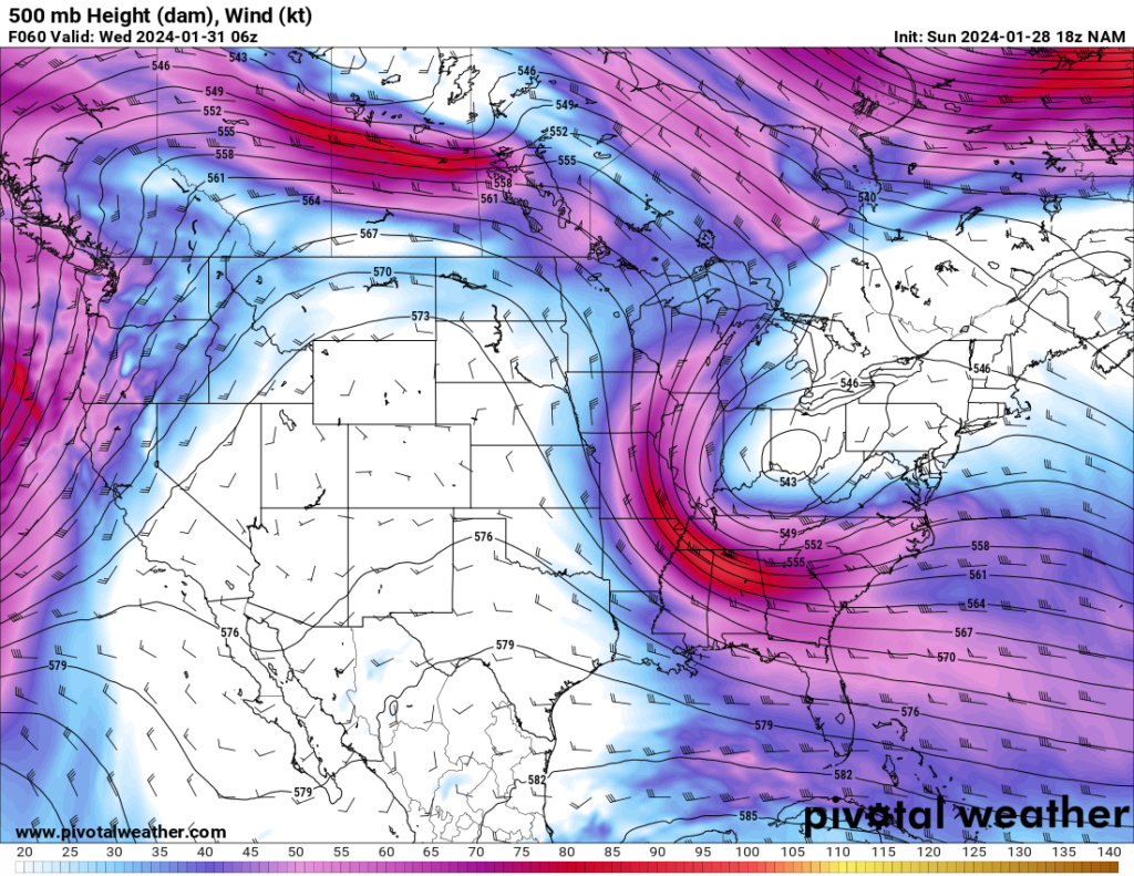
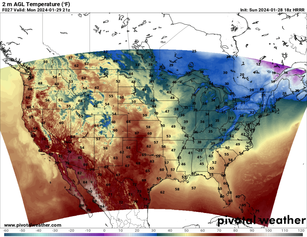
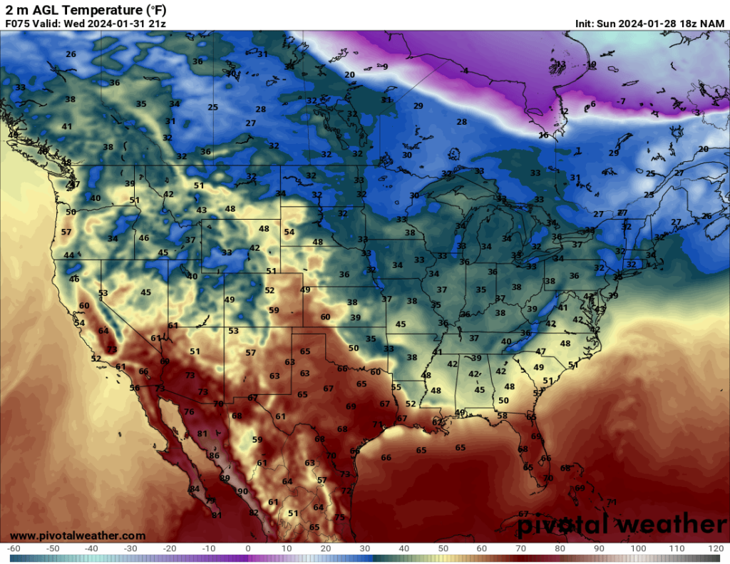
The ridging over the Southwest will result in relatively warm temperatures over the Southwest and southern Plains and cool to cold temperatures in the eastern third of the country. This temperature trend will hold fairly steady over the next few days.
Most of the country will be dry for the first half of the week. Some rain and snow will be possible in parts of the Midwest and Mid-Atlantic states on Tuesday and early Wednesday ahead of the trough that is visible in the first image. Additionally, much of California will likely see heavy rain (or snow in the higher elevations) late Wednesday and Thursday. Aside from that, most states will see dry weather through Thursday.


