Howdy!
You might have heard about the tropical disturbance in the gulf… but is it actually going to develop into something that will impact us? Let’s see.
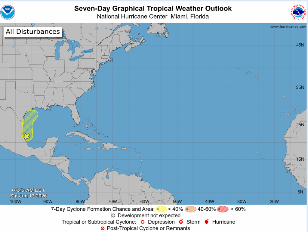
So! The National Hurricane Center has marked an area off the coast of Mexico that has the potential to develop into a tropical storm or hurricane. It is a broad area of low pressure that is producing disorganized showers and thunderstorms, but it has become better organized in the last couple of days.
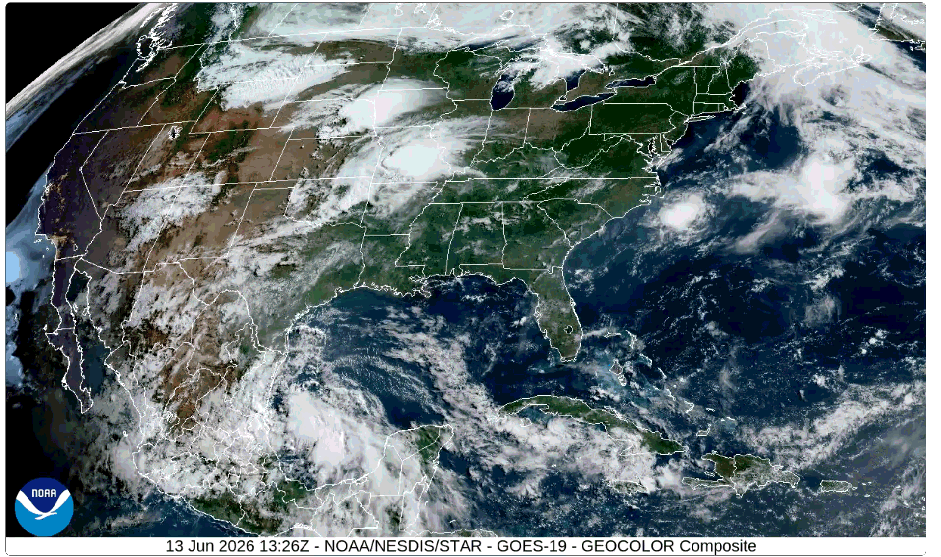
Let’s look below out the window at what exactly is going on right now. We can see those thunderstorms off the coast of Mexico currently and it looks like they are propagating right into the country.
By overnight Saturday into Sunday, the low will continue moving northwest inland to Mexico, producing rainfall for the northeastern part of the country. The National Hurricane Center predicts that the system could re-emerge over the gulf Tuesday or Wednesday while it interacts with the frontal boundary that will impact our region next week. With all of this though, environmental conditions are only marginally favorable for development, so it is unlikely the system will become anything significant.

Above is the wind shear between 200mb-850mb. The area itself has lower shear, but much of the gulf and surrounding area has moderate to higher wind shear that will limit the system’s ability to develop into something deeper. Since it is moving inland and not remaining over waters, it loses its ability to develop a lot more, therefore reducing potential.
While it is not expected that the system will develop into anything that will be a hazard to us, it is bringing with it an abundant amount of moisture (see below on the Total Precipitable Water model).
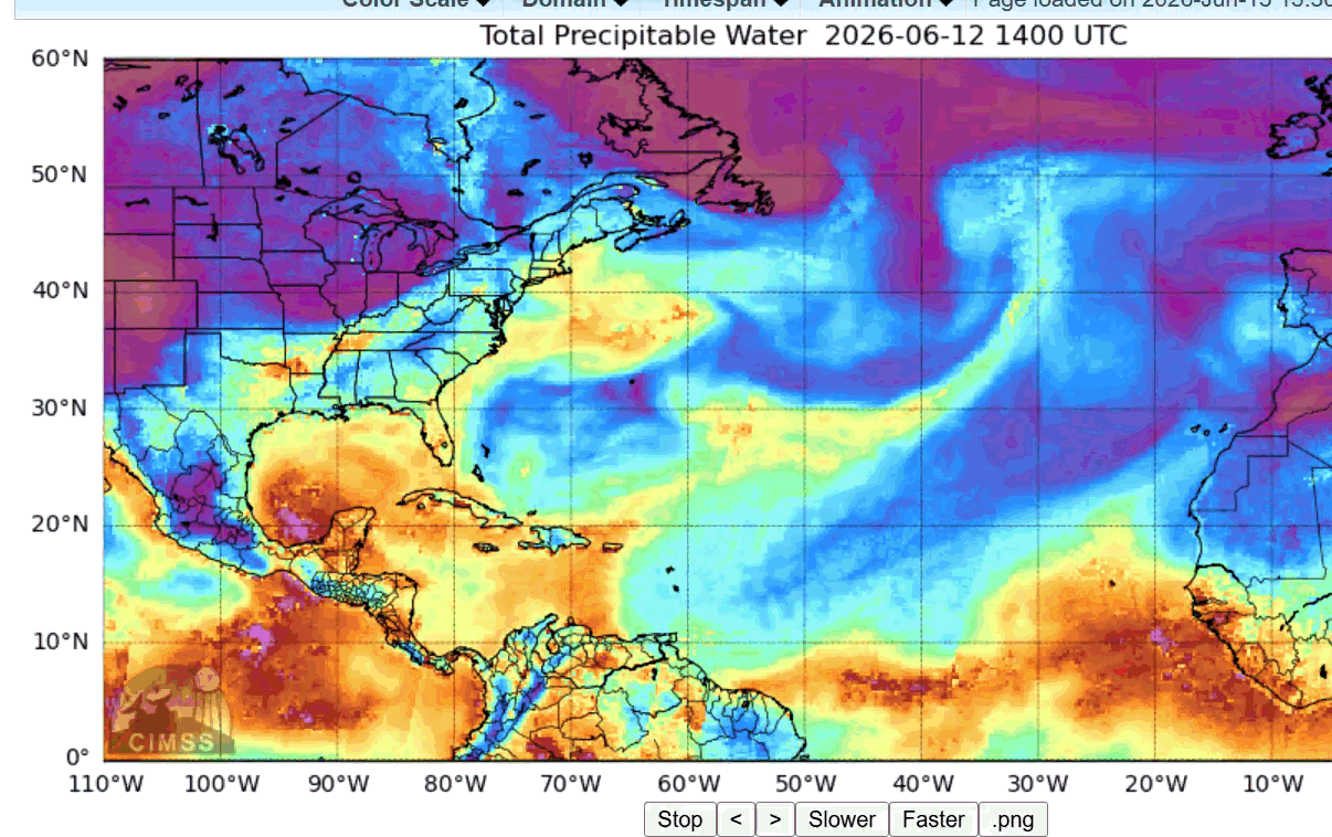
This moisture paired with the frontal boundary that will impact us early next week will produce a lot of rainfall for southeast United States and Texas. It’s interaction with the Atlantic Ridge extending into the northeast is producing a tight pressure gradient that will cause strong winds and rough seas for the gulf.
Again, no significant development is expected, so no need to panic over this! The very impact expected from the system is heavy rainfall with all that tropical moisture. Even so, make sure to keep up to date with the weather. Thanks, and enjoy the rest of your Saturday!


