I get a lot of questions about why some situations have a lower tornado threat than others, and why when the tornado threat is low, there are still tornadoes that occur. While every situation is different, I figured thisd last setup may be a good one to look at for starters.
With this last case, I mentioned that it was all about storm motion. Storms were moving from northwest to southeast and that was going to make it a bit more difficult for storms to produce tornadoes. Because orientation and storm motion matter. And model guidance is often terrible at forecasting orientation and storm motion. And storm motion matters because how storms are oriented relative to the environment and to their forward motion help dictate how storms end up being organized.
And organization in storms is very, very important.
As an aside, if you are a research meteorologist of a mesoscale expert, please try your best to not ‘well actually’ me on this post. This is a deliberate attempt to breakdown a very complicated process into easier to digest bites. It won’t be 100-percent true to the science, but it is also being explained with no math, so please allow me some leash.
Supercells
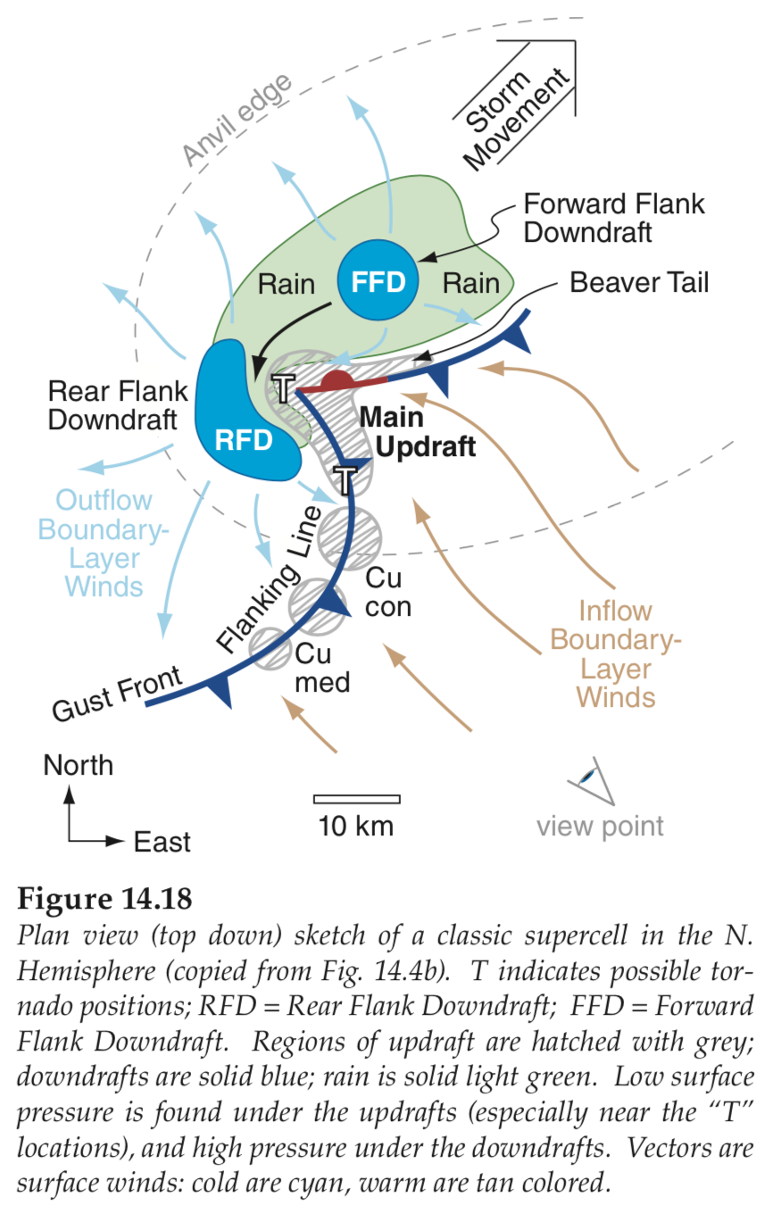
Let’s start with the A-Typical supercell thunderstorm. These are also called mesocyclones. These storms are organized in a way that allows the heaviest rain to fall in one area, hail to fall in another, gusty wind to be localized in another spot and have the potential to produce a tornado in another place.


A fancier version of the above image that I drew while eating lunch looks like this:
These storms are often the most likely types of storms to produce tornadoes. And the number one thing they need to do this is warm, moist air. If we don’t have instability along with warm air, we can’t get this train moving.

But that isn’t the only thing. They also need the storm to be aligned in a way that pulls in warm air and uses the wind of the atmosphere to deposit the cooler air in a place that is in a different space than where the warmer air is entering the storm.
This often means the atmosphere needs to have a change in wind speed and direction as you move up higher and higher in the atmosphere. Below we see the same supercell on the left and the wind direction at different levels of the atmosphere on the right.

When the storm is aligned like this, moving to the northeast, we end up in a very favorable situation for organizing the storm correctly. I often compare these storms to having a PacMan mouth and it is eating up the warm, moist air.

And when he is chomnping along moving to the east or northeast, he has plenty of warm air to chomp on. And the wind direction and speed is helping the PacMan redistribute things evenly in the right places.
And that also means, we could produce a tornado – if all of the other things were lined up correctly – in this storm. And it would form in the black circled area.

But what happens when we tilt the storm to move in a different direction?

Well, it looks like there is still plenty of warm air to eat, but now the wind direction and speed in our atmosphere aren’t built to sustain the storm, so it wouldn’t survive. Instead, we need the wind to be aligned differently in order for a supercell to form and move in this kind of direction.
The dint would need to look like the example below, on the right. But it creates a problem. Now we can’t get that warm moist air directly into the center of the storm. It can ride in along the baroclinicity of the boundary betweent he warm air and the Forward-Flank Downdraft, but the wind at the lowest levels at the surface won’t allow that to happen as easily.

So it is not likely for a tornado to form in this situation. Instead, heavy rain and hail would be the main concern here.
But, Nick, we DID have tornadoes! What gives?!
You are spot on! We did! And it is for a very good reason.
The storms changed direction.
As the line of storms pushed through the area, the trajectory of certain storms changed and those particular storms shifted to move more easterly and even, in some cases northeasterly. That same diagream from above looked more like the diagram below. And that surface wind could push all the way into the center of the storm with no problems.

That is why the Tornado Warnings were more west-east than the Severe Thunderstorm Warnings.


Proof? Sure thing!
Model Data
Like I was saying, the models tend to struggle with resolving this kind of problem. Too far out in time, they simply can’t know if storms will turn or if the atmospheric conditions will allow such a thing to happen.
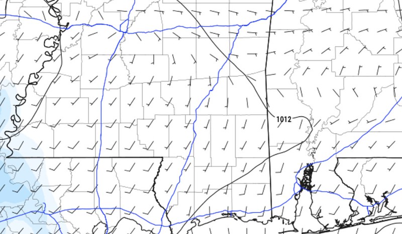
For example, here is a look at the Storm Motion estimate from the NAM model on Sunday morning. The red circled area shows the direction the model guidance thought all the storms would go in the evening on Sunday.

But, later that afternoon and into the evening, the next round of model data came out and BAM! the storm motion on teh model data was now showing a more east-west alignment and evening a few dots of southwest to northeast movement.

And that was on top of wind in the lower levels that had shifted from the west-southwest to more south-southwest
That change storm motion and alignment from the image on the left to the image on the right.
And we went from a “no tornado” atmosphere to “okay, tornado” atmosphere really quickly. Below is a look at the same model data, the NAM, at 9p. It shows a very favorable wind profile, plenty of SRH, Shear, CAPE, and even a veer-back-veer profile on the hodograph.

And what did we get at 8:58pm? A tornado.

And we were able to do so because all of the other puzzle pieces were in place. All we needed to do was reorient the storm motion and wind. Then –poof!– tornado.
The Bottom Line
It isn’t always this easy to diagnose why tornadoes formed one day versus another, but this is a great example of having all of the right pieces in place except for one… until even that piece was in place for a short period of time.
The truth is that weather is complicated, but sometimes it can be simple.
This is a case where it is both complicated and simple.
While we have modeling that did a good job this one time, the next time it may not. And the last time, before this example, it definitely didn’t. So it is difficult as a forecaster to say, “okay, I’m going to trust this model!” because you can get burned.
But it was simple because we had everything we needed to get a few tornadoes and it was going to be a case of ‘right place, right time’ to squeeze one out. That is why I said in my forecast from earlier in the day that, “while severe weather is possible, the threat for tornadoes will be pretty low. Not zero, but it will take Mary Poppins-like set of events (practically perfect in every way) in order to pull one out of the clouds.”


It was a classic hail-to-tornado supercell day. Made me remember the Panhandles days fondly. One of the other forecasters and I remarked how the atmosphere on Sunday resembled a May Oklahoma atmosphere many times that day. Very interesting.