South Mississippi Forecast Page
Hey guys, Nick Lilja here! Welcome to your new one-stop spot for South Mississippi weather data. This page will house the latest forecasts, radar data, SPC and NHC outlooks and more!
No need to download an app and clog your phone! Just bookmark this page and add it to your homescreen (for more info on how to do that, click here)!
Recent Forecasts
- Nearing the end of Tropical Storm Bertha: Forecast refresh 7/23/2026
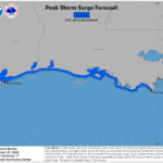 Howdy! For more discussion on the weather, watch my video forecast below! Tropical Storm Bertha is currently moving along and off the coast of southern Louisiana, producing scattered rainfall for the state, the main convective…
Read more of Nearing the end of Tropical Storm Bertha: Forecast refresh 7/23/2026
- Tropical Storm Bertha is here: Southern LA/MS/AL forecast – 7/22/2026
 Howdy! Tropical Storm Bertha is currently impacting the region, expected to produce some locally heavy rainfall and strong winds. Some localized flash flooding is possible, rain amounts ranging from 1-4 inches. By Friday, the storm…
Read more of Tropical Storm Bertha is here: Southern LA/MS/AL forecast – 7/22/2026
- Gulf Coast Forecast Refresh – 07/22/26
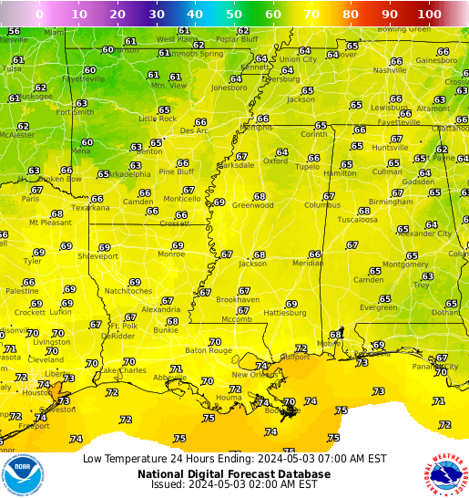
 Good afternoon! As of noon CDT, the temperatures are rising, with a few spots already hitting 90ºF. These temperatures will continue to rise until about 4 this afternoon, when highs should reach the mid-upper 90s…
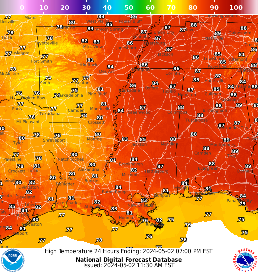
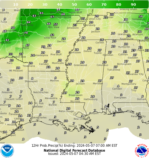
Regional Forecast Graphics
Local NWS Forecast Discussion
Here is a look at the local forecast from the local NWS:
Interactive Radar
Here is a look at the local radar:
Storm Prediction Center Outlook


SPC Discussion:
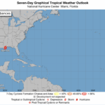
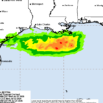
National Hurricane Center Forecast

NHC Tropical Atlantic Discussion:
NHC Full Tropics Discussion:
Recent Tropical Weather Forecast Breakdowns
- Tropical Forecast – 7/22/26
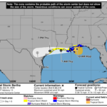
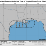
 Happy Wednesday! Currently, Tropical Storm Bertha’s center is moving westward over southeastern Louisiana. A Tropical Storm Warning is extended from the AL to LA coast. Portions of the Texas coast are under a Tropical Storm Watch. There is also a Coastal Flood Warning for the Mississippi and Louisiana coastlines. The maximum sustained winds are 45…
 - Gulf Coast Forecast Refresh – 07/22/26Good afternoon! As of noon CDT, the temperatures are rising, with a few spots already hitting 90ºF. These temperatures will continue to rise until about 4 this afternoon, when highs should reach the mid-upper 90s for most spots. As always, make sure to hydrate yourself adequately, avoid difficult physical labor outdoors for extended periods of…
- Bertha Nears Gulf Coast Landfall- 7/22/26 Regional Forecast
 Tropical Storm Bertha is anticipated to make landfall this evening near the central Louisiana coast as a tropical storm with wind speeds of around 46 mph. Tropical Storm Bertha is currently located about 110 miles west-southwest of Panama City, Florida, moving west at a little less than 6mph. Bertha has maximum sustained winds of 58…
Read more of Bertha Nears Gulf Coast Landfall- 7/22/26 Regional Forecast

