Several soundings (both observed and model) were analyzed and compared in order to decipher the potential failure modes. The first sounding that was analyzed was the 18z launch from Norman, Oklahoma. This area was inside the SPC high risk and just south of the effective warm front.
Several characteristics indicated that this would be a favorable environment for tornadic supercells. The moist layer extended up to around 700mb and there was significant veering and strengthening of the winds as the parcel ascended. The LFC and LCL were low to the ground, which is known to be favorable for tornado genesis (Davies 2004). The main flaw in the profile was the lapse rates.
Since the profile was fairly saturated, the low-level lapse rates were basically moist adiabatic. On paper there was a large amount of surface-based CAPE and zero to three kilometer CAPE, but due to the weak lapse rates, convection may struggle to become robust (Tuckman at al. 2023). A supercell fired in this environment to the northwest of Norman and produced two brief tornadoes as it crossed the warm front, after which it became elevated.
By 2pm, widespread weak showers had developed across the warm sector in Oklahoma.
Frederick Oklahoma radar reflectivity at 1:18 pm depicting showers developing across the warm sector in the high risk zone.
Despite the seemingly favorable environment, none of the convection was able to substantially deepen into established thunderstorms. A supercell that had organized out of a cluster of morning convection across the Texas South Plains was able to produce several tornadoes across northwest Texas and southwest Oklahoma, including an EF2, however the rest of the warm sector failed to initiate sustained convection.
Eventually, elevated convection that formed on the cool side of the front surged south and forced stable air through the warm sector.
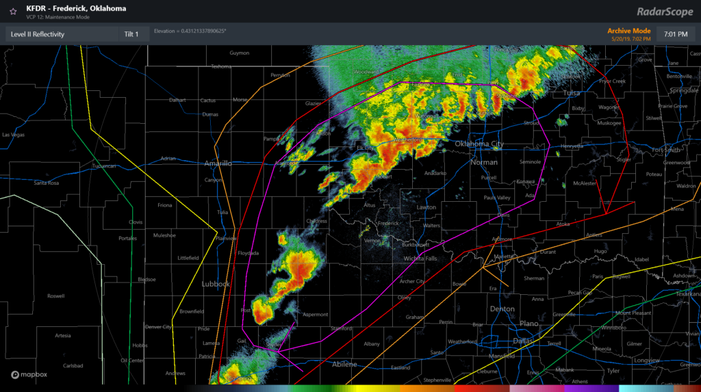
Frederick Oklahoma radar reflectivity at 7:02 pm showing that the front has surged south, causing convection to grow upscale. Note that there is no warm sector development south or east of the QLCS.
These storms were not supercells and although they produced a few weak tornadoes, it was far from what was expected. Down in southwest Texas, several supercells that formed on the dryline were able to produce tornadoes, despite the slightly less favorable environment as compared to further northeast.


