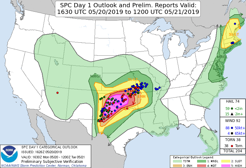
On May 20, 2019, a major tornado outbreak was expected across the southern Plains, centered on Oklahoma and northwest Texas. The region was highlighted by a rare level four (out of five) moderate risk on the day three Storm Prediction Center convective outlook. By late morning on the day of the event, portions of Oklahoma and Texas were placed under an extremely rare 45 hatched tornado outlook on the probabilistic outlook, with a level five out of five (HIGH) risk in place on the categorical outlook.
A potentially historic tornado outbreak was expected to occur from the Texas Caprock east to the Cross Timbers and south to the I-20 corridor, with multiple waves of highly discrete, long-tracked supercells (Galarneau at al. 2026).
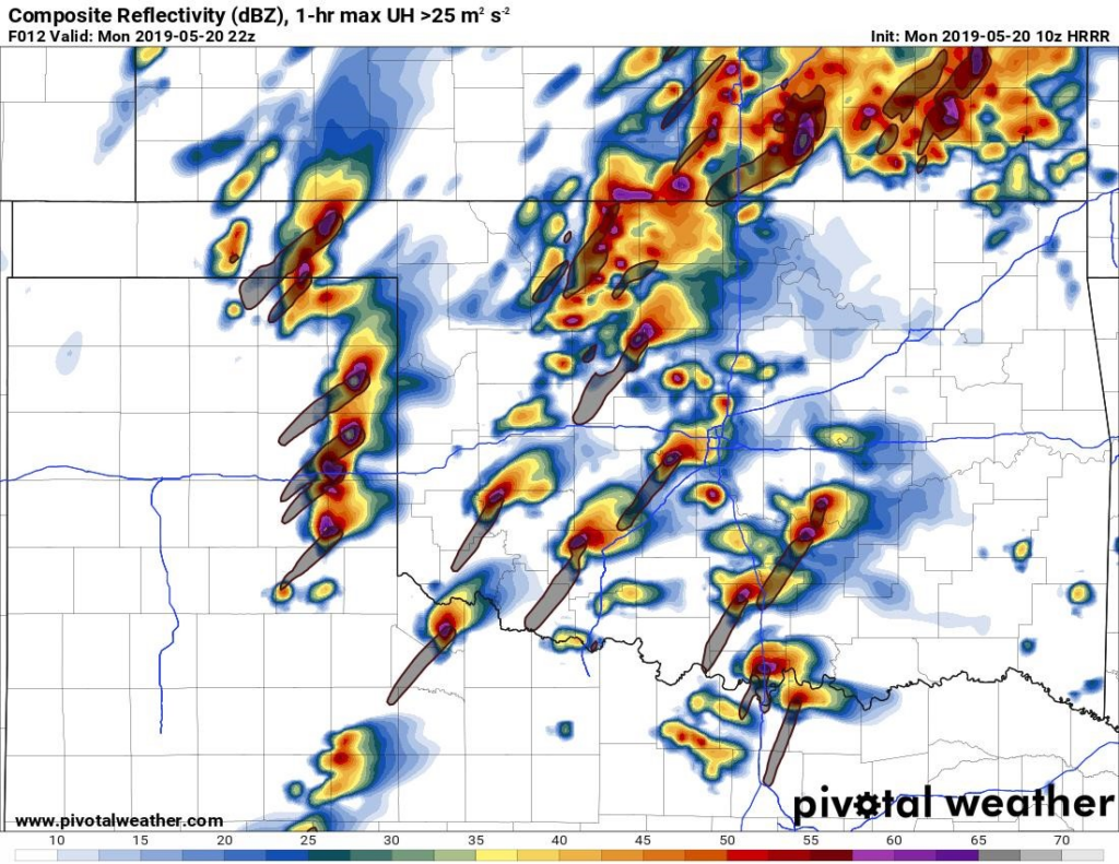
The 10z HRRR from the morning of the event depicted numerous intense warm sector supercells ahead of the dryline.
Ultimately, 42 tornadoes would touch down, including several which were significant. Overall, however, the event was a significant under performance compared to what was expected, with most of the tornadic activity further southwest into Texas or embedded in a QLCS in Oklahoma. The highest threat area was almost completely void of supercells until the QLCS pushed through in the evening.
There were several reasons that the forecast did not verify, including weak forcing across the open warm sector, persistent low-level cloud cover, a surging cold front, and lastly (and potentially most importantly) a small warm nose around 700hPa in the open warm sector. This paper will seek to clarify the role that each of the failure modes had in causing a much different event than the models had predicted. The main focus will be on the differences between the observed soundings (from Norman, Oklahoma, and Fort Worth, Texas) compared to model soundings and why these seemingly small differences were able to so dramatically impact what seemed to be a historic event.


